1973 Map of Kimball 1 SE
USGS Topo · Published 1974About this map
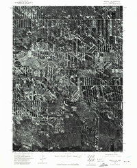
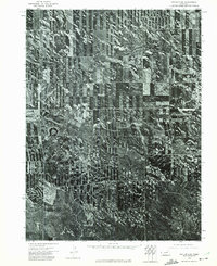
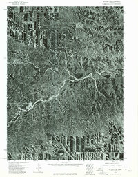
Lodgepole Creek winds through this agricultural section of Kimball County, Nebraska, captured in a detailed orthophotomosaic from May 1973. This specialized aerial-photo map reveals the precise geometry of High Plains dryland farming and center-pivot irrigation patterns that defined the rural landscape during this period. The orthophoto format provides a clear view of the vegetation and terrain along the creek valley, contrasting with the strictly gridded fields that dominate the surrounding plateau. In the southwestern corner, Bennett Reservoir appears as a critical water management feature, supporting the region's cattle and grain production. This record offers a literal look at land use, showing exactly how the soil was tilled and where natural drainage channels intersected the human-engineered square-mile sections of the Western Nebraska panhandle.
Find a feature on this map
2 named features on this map. Tap any name to fly to it.
Don’t see what you’re looking for? This feature index may not catch every label — zoom into the map to look around manually.
Map Details
Editions of this 1973 Kimball 1 SE Map
This is the sole edition of this map. No revisions or reprints were ever made.
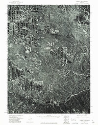
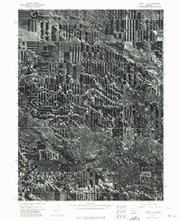
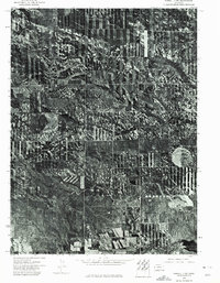
Other maps of this area

1954 · Scottsbluff
USGS Topo · 1:250,000

1958 · Scottsbluff
USGS Topo · 1:250,000
1972 · Dix
USGS Topo · 1:24,000
1972 · Owasco
USGS Topo · 1:24,000
1972 · Kimball
USGS Topo · 1:24,000
1973 · Potter 2 SW
USGS Topo · 1:24,000
1973 · Kimball 1 NE
USGS Topo · 1:24,000
1973 · Kimball 1 NW
USGS Topo · 1:24,000
1973 · Kimball 1 SW
USGS Topo · 1:24,000
1973 · Potter 2 NW
USGS Topo · 1:24,000