
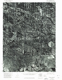
1973 Map of Kimball 1 NE
USGS Topo · Published 1975About this map
Agricultural strip cropping creates a striking geometric pattern across the High Plains landscape of Banner County in the early 1970s. This orthophotoquad reveals the intricate relationship between modern soil conservation practices and the underlying topography of the Nebraska Panhandle. The most prominent natural drainage system, Rocky Hollow, carves a winding path through the center and southern reaches of the map, revealing the erosion patterns that define this upland environment. The high-contrast imagery highlights the stark transition between cultivated fields and the native breaks and gullies that remain unsuitable for the plow, providing a clear record of land use and environmental management during this era of industrialized farming.
Find a feature on this map
1 named feature on this map. Tap any name to fly to it.
Don’t see what you’re looking for? This feature index may not catch every label — zoom into the map to look around manually.
Map Details
Editions of this 1973 Kimball 1 NE Map
This is the sole edition of this map. No revisions or reprints were ever made.
Other maps of this area

1898 · Scotts Bluff
USGS Topo · 1:125,000

1898 · Camp Clarke
USGS Topo · 1:125,000

1954 · Scottsbluff
USGS Topo · 1:250,000

1958 · Scottsbluff
USGS Topo · 1:250,000

1973 · Potter 2 SW
USGS Topo · 1:24,000

1973 · Scotts Bluff 4 SE
USGS Topo · 1:24,000

1973 · Kimball 1 SE
USGS Topo · 1:24,000

1973 · Scotts Bluff 4 SW
USGS Topo · 1:24,000

1973 · Kimball 1 NW
USGS Topo · 1:24,000
1973 · Kimball 1 SW
USGS Topo · 1:24,000