Old Maps of Banner County, Nebraska
Explore 132 old maps of Banner County, spanning from 1898 to today. These high-resolution historic maps reveal how streets, neighborhoods, landmarks, and natural features evolved over time — perfect for genealogy, metal detecting, research, and local history exploration.
What you can do with these maps:
- See how Banner County changed over time: Compare historical maps to modern-day views to trace roads, homesites, rail lines & more.
- View detailed metadata: Each map includes creators, publishers, year, scale, and archive source.
- Overlay maps with satellite & LiDAR: Visualize the past alongside modern tools to explore terrain & human change.
- Trusted historical sources: Maps sourced from the USGS, Library of Congress, and other archives.
- Access maps your way: View online, download high-res files, or order prints for personal or research use.
Start exploring old maps of Banner County to uncover forgotten places, hidden landmarks, and the deep history beneath your feet.
Banner County, NE maps
(132)- 1898 Map of Scotts Bluff
 1898 Scotts Bluff1898 Print · USGSWestern Nebraska at the end of the century was a landscape of emerging irrigation and prominent landmarks. You can trace the development of early irrigation canals along the North Platte River and locate historic sites like Gering, Roubedeau Pass, and Castle Rock.5 unique versions available
 - 1898 Map of Camp Clarke
 1898 Camp Clarke1898 Print · USGSThe Nebraska panhandle in the late nineteenth century is documented here through its early irrigation canals and iconic trail landmarks. Researchers can trace early settlements like Camp Clarke and Bayard alongside famous geologic features including Chimney Rock and Courthouse Rock.5 unique versions available
 - 1899 Map of Goshen Hole
 1899 Goshen Hole1899 Print · USGSThe High Plains of the Wyoming-Nebraska borderlands come into focus at the close of the nineteenth century. Researchers can trace the early cattle ranching economy through named homesteads like Greasewood Ranch and Robb's Ranch, and locate landmarks such as Ninemile Rock.4 unique versions available
 - 1954 Map of Scottsbluff, 1958 Print
 1954 Scottsbluff1958 Print · USGSThe Nebraska Panhandle's iconic landmarks and rail corridors are captured here during the mid-1950s. Researchers can trace the path of the North Platte River past Chimney Rock or locate the sprawling Sioux Ordnance Depot and the historic streets of Sidney.3 unique versions available
 - 1954 Map of Cheyenne, 1963 Print
 1954 Cheyenne1963 Print · USGSSoutheastern Wyoming's high plains and the capital city's mid-century expansion are documented here during the early Cold War. Genealogists and historians can trace rail-aligned settlements like Pine Bluffs and Hillsdale, or explore landmarks like the Ames Monument and Francis E. Warren Air Force Base.3 unique versions available
 - 1958 Map of Cheyenne
 1958 Cheyenne1958 Print · USGSSoutheast Wyoming and the Nebraska border appear in the late 1950s as a hub of military defense and rail commerce. Genealogists can trace the Union Pacific through Cheyenne or locate the Horse Creek Oil Field and the State Capitol.2 unique versions available
 - 1958 Map of Scottsbluff
 1958 Scottsbluff1958 Print · USGSThe Nebraska panhandle in the late fifties was a vital corridor of rail-and-river transport defined by the North Platte River and the Union Pacific. Genealogists and historians can trace rail stops like Reddus Station, explore the grounds of the Sioux Ordnance Depot, or locate landmarks like Chimney Rock.2 unique versions available
 - 1960 Map of Tremain
 1960 Tremain1960 Print · USGSThe high plains of the Wyoming-Nebraska border come into focus in 1960, showing a landscape defined by cattle ranching and rail infrastructure. Researchers can trace historic family-named homesteads like Bull Canyon Ranch and Spahr Ranch alongside the Epworth Cem.3 unique versions available
 - 1960 Map of Mc Compsey Pass, 1962 Print
 1960 Mc Compsey Pass1962 Print · USGSThe Wyoming-Nebraska borderlands in the early sixties reveal a landscape defined by isolated ranches and essential water sources. Trace the movement of livestock and early settlers through Mc Compsey Pass, the Spahr Ranch, and remote landmarks like Devils Armchair.3 unique versions available
 - 1960 Map of Murray Lake, 1962 Print
 1960 Murray Lake1962 Print · USGSThe high plains of Banner County and Scotts Bluff County are captured here in the early 1960s, showing a landscape of deep canyons and isolated homesteads. Genealogists and local historians can trace the Stegall South Road to the Pleasant Hill Cem or locate seasonal water at Murray Lake.2 unique versions available
 - 1965 Map of South Bayard, 1967 Print
 1965 South Bayard1967 Print · USGSMorrill County and the North Platte River valley are captured here in the mid-1960s, a landscape defined by pioneer history and modern irrigation. You can trace the path of the Emigrant Trail past Chimney Rock and locate rural landmarks like School No 50 and Facus Springs.
 - 1965 Map of McGrew, 1967 Print
 1965 McGrew1967 Print · USGSThe North Platte River valley in the mid-1960s highlights the vital rail-and-water infrastructure of western Nebraska. Researchers can trace historic landmarks like High Butte Cem or navigate the gaps of the Wrights range through Williams Gap and Hubbard Gap.
 - 1973 Map of Scotts Bluff 4 NW, 1974 Print
 1973 Scotts Bluff 4 NW1974 Print · USGSBanner County in the early seventies is documented here through high-resolution aerial imagery rather than traditional line drawing. You can trace the path of the Fort Laramie Canal and the natural terrain around Hogback Mountain and Pumpkin Creek.
 - 1973 Map of Kimball 2 NE, 1974 Print
 1973 Kimball 2 NE1974 Print · USGSBanner County, Nebraska, is seen here in the early seventies through a detailed aerial perspective of its agricultural and ranching heartland. Genealogists and researchers can trace the natural contours of Rocky Hollow and examine the specific layout of historical farmsteads and irrigation patterns.
 - 1973 Map of Scotts Bluff 4 SE, 1974 Print
 1973 Scotts Bluff 4 SE1974 Print · USGSBanner County ranchlands and high plains agriculture are captured here during the early 1970s. Researchers can trace the natural drainage of Indian Springs Creek or locate the distinct landforms of Bighorn Mountain and Bighorn Gulch.
 - 1973 Map of Scotts Bluff 4 NE, 1974 Print
 1973 Scotts Bluff 4 NE1974 Print · USGSBanner County, Nebraska, comes into sharp focus in the early 1970s through high-altitude aerial photography. Trace the winding path of Pumpkin Creek and study the detailed patterns of agricultural development across this rural landscape.
 - 1973 Map of Scotts Bluff 4 SW, 1974 Print
 1973 Scotts Bluff 4 SW1974 Print · USGSBanner County comes into focus in the early seventies, showcasing the agricultural geometry of the Nebraska panhandle. Genealogists and local historians can trace the layout of the unincorporated community of Harrisburg and its surrounding ranching land.
 - 1973 Map of Scotts Bluff 3 SE, 1975 Print
 1973 Scotts Bluff 3 SE1975 Print · USGSBanner County agriculture in the early seventies is defined here by the sharp contrast between center-pivot irrigation and the natural Nebraska terrain. Researchers can trace the path of Willow Creek and locate landmarks like Gabe Rock.
 - 1973 Map of Kimball 1 NE, 1975 Print
 1973 Kimball 1 NE1975 Print · USGSBanner County farmland meets the deep drainage of Rocky Hollow in the early seventies, as shown in this detailed orthophoto. Local historians can trace the precise boundaries of agricultural strip cropping and the natural terrain of the Nebraska Panhandle.
 - 1973 Map of Kimball 2 NW, 1975 Print
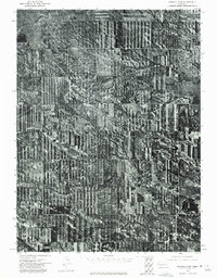 1973 Kimball 2 NW1975 Print · USGSAgricultural patterns in the Nebraska Panhandle are preserved here as they appeared in the early seventies through detailed aerial photography. Local historians and land researchers can trace the natural contours of Long Canyon and the layout of mid-century strip-cropping.
 - 1973 Map of Kimball 1 NW, 1975 Print
 1973 Kimball 1 NW1975 Print · USGSBanner County’s high plains and agricultural geometry are frozen in time during the early 1970s. Trace the intricate land-use patterns surrounding Rocky Hollow, where the interplay of water and wheat farming shapes the rural Nebraska panhandle.
 - 1973 Map of Scotts Bluff 3 SW, 1975 Print
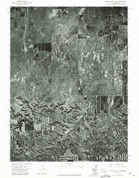 1973 Scotts Bluff 3 SW1975 Print · USGSWestern Nebraska land use is revealed in high detail during the early 1970s, showing the intersection of high plains ranching and intensive farming. Trace the natural drainage of Long Canyon and the rugged breaks of Bull Canyon amidst a patchwork of cultivated fields.
 - 1973 Map of Scotts Bluff 3 NE, 1975 Print
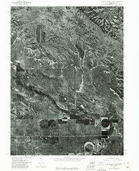 1973 Scotts Bluff 3 NE1975 Print · USGSBanner County agriculture and the rugged Nebraska panhandle terrain meet in the early seventies along the banks of Pumpkin Creek. Researchers can examine the detailed aerial layout of center-pivot irrigation fields and the natural drainage of the tablelands.
 - 1973 Map of Potter 2 NW, 1975 Print
 1973 Potter 2 NW1975 Print · USGSBanner County ranchlands and high plains fields are captured from above during the early 1970s. Trace the path of Lawrence Fork or the distinct terrain of Rocky Hollow to see how this landscape was shaped by both nature and agriculture.
 - 1973 Map of Potter 2 NE, 1975 Print
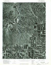 1973 Potter 2 NE1975 Print · USGSWestern Nebraska farming and ranching landscapes are captured in detail during the early 1970s. Trace the intricate, winding course of the Lawrence Fork as it cuts through the high plains topography and established agricultural boundaries.
Showing maps 1-25 of 132
Top cities of Banner County
Frequently asked questions
- What are the different types of historical maps available for Banner County?
- What is the oldest map of Banner County?
- Where can I purchase historical maps of Banner County for my home or office?
- Where can I download high-res historical maps of Banner County?
- Are there historical topographic maps available for Banner County?
- Is there historical aerial imagery available for Banner County?
- Where are historical maps of Banner County sourced from?