1970s Maps of Banner County, Nebraska
Explore 30 historic maps of Banner County from the 1970s. These maps offer a rare glimpse into what life looked like during the 1970s — showing old roads, neighborhoods, homes, and landmarks that have changed or disappeared over time.
Whether you're researching your family's past, planning a metal detecting trip, or studying how Banner County's landscape evolved across the 1970s, these high-resolution maps are a powerful tool for exploring the history of this region.
- Focus on a specific era: All maps on this page are from the 1970s, giving you a focused view of this time period.
- See what’s changed: Compare century-old streets, trails, and buildings to today's modern landscape using overlays and satellite layers.
- Research with precision: Use these maps for genealogy, historical research, land use analysis, or educational projects.
- View, download, or print: Maps are fully viewable online in high resolution, and can be downloaded or printed for your own records.
Start exploring Banner County's history through authentic maps from the 1970s. This is your window into the past.
Banner County, NE maps
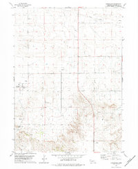
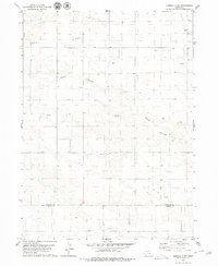
(30)- 1973 Map of Scotts Bluff 4 NW, 1974 Print
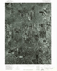
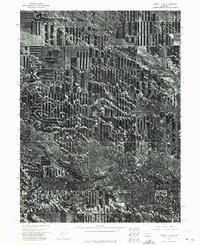
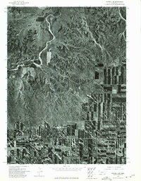
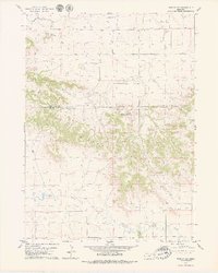
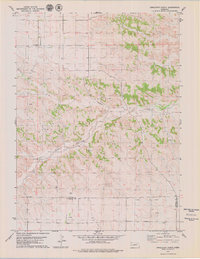
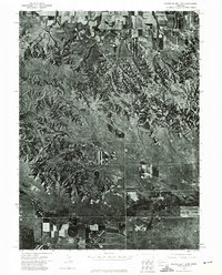 1973 Scotts Bluff 4 NW1974 Print · USGSBanner County in the early seventies is documented here through high-resolution aerial imagery rather than traditional line drawing. You can trace the path of the Fort Laramie Canal and the natural terrain around Hogback Mountain and Pumpkin Creek.
 - 1973 Map of Kimball 2 NE, 1974 Print
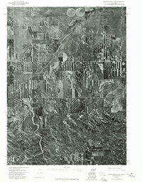
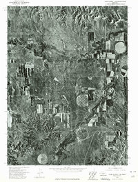
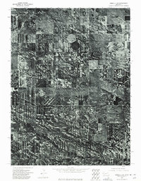 1973 Kimball 2 NE1974 Print · USGSBanner County, Nebraska, is seen here in the early seventies through a detailed aerial perspective of its agricultural and ranching heartland. Genealogists and researchers can trace the natural contours of Rocky Hollow and examine the specific layout of historical farmsteads and irrigation patterns.
 - 1973 Map of Scotts Bluff 4 SE, 1974 Print
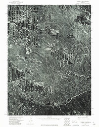
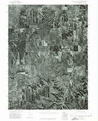 1973 Scotts Bluff 4 SE1974 Print · USGSBanner County ranchlands and high plains agriculture are captured here during the early 1970s. Researchers can trace the natural drainage of Indian Springs Creek or locate the distinct landforms of Bighorn Mountain and Bighorn Gulch.
 - 1973 Map of Scotts Bluff 4 NE, 1974 Print
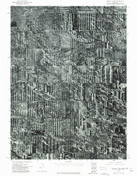
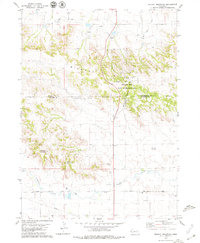
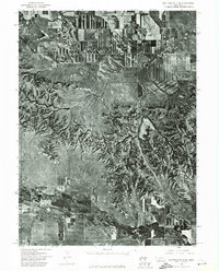 1973 Scotts Bluff 4 NE1974 Print · USGSBanner County, Nebraska, comes into sharp focus in the early 1970s through high-altitude aerial photography. Trace the winding path of Pumpkin Creek and study the detailed patterns of agricultural development across this rural landscape.
 - 1973 Map of Scotts Bluff 4 SW, 1974 Print
 1973 Scotts Bluff 4 SW1974 Print · USGSBanner County comes into focus in the early seventies, showcasing the agricultural geometry of the Nebraska panhandle. Genealogists and local historians can trace the layout of the unincorporated community of Harrisburg and its surrounding ranching land.
 - 1973 Map of Scotts Bluff 3 SE, 1975 Print
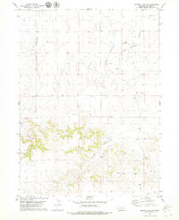
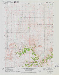
 1973 Scotts Bluff 3 SE1975 Print · USGSBanner County agriculture in the early seventies is defined here by the sharp contrast between center-pivot irrigation and the natural Nebraska terrain. Researchers can trace the path of Willow Creek and locate landmarks like Gabe Rock.
 - 1973 Map of Kimball 1 NE, 1975 Print
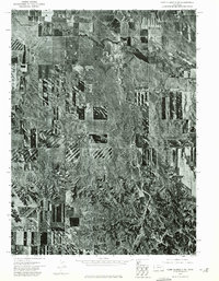
 1973 Kimball 1 NE1975 Print · USGSBanner County farmland meets the deep drainage of Rocky Hollow in the early seventies, as shown in this detailed orthophoto. Local historians can trace the precise boundaries of agricultural strip cropping and the natural terrain of the Nebraska Panhandle.
 - 1973 Map of Kimball 2 NW, 1975 Print
 1973 Kimball 2 NW1975 Print · USGSAgricultural patterns in the Nebraska Panhandle are preserved here as they appeared in the early seventies through detailed aerial photography. Local historians and land researchers can trace the natural contours of Long Canyon and the layout of mid-century strip-cropping.
 - 1973 Map of Kimball 1 NW, 1975 Print
 1973 Kimball 1 NW1975 Print · USGSBanner County’s high plains and agricultural geometry are frozen in time during the early 1970s. Trace the intricate land-use patterns surrounding Rocky Hollow, where the interplay of water and wheat farming shapes the rural Nebraska panhandle.
 - 1973 Map of Scotts Bluff 3 SW, 1975 Print
 1973 Scotts Bluff 3 SW1975 Print · USGSWestern Nebraska land use is revealed in high detail during the early 1970s, showing the intersection of high plains ranching and intensive farming. Trace the natural drainage of Long Canyon and the rugged breaks of Bull Canyon amidst a patchwork of cultivated fields.
 - 1973 Map of Scotts Bluff 3 NE, 1975 Print
 1973 Scotts Bluff 3 NE1975 Print · USGSBanner County agriculture and the rugged Nebraska panhandle terrain meet in the early seventies along the banks of Pumpkin Creek. Researchers can examine the detailed aerial layout of center-pivot irrigation fields and the natural drainage of the tablelands.
 - 1973 Map of Potter 2 NW, 1975 Print
 1973 Potter 2 NW1975 Print · USGSBanner County ranchlands and high plains fields are captured from above during the early 1970s. Trace the path of Lawrence Fork or the distinct terrain of Rocky Hollow to see how this landscape was shaped by both nature and agriculture.
 - 1973 Map of Potter 2 NE, 1975 Print
 1973 Potter 2 NE1975 Print · USGSWestern Nebraska farming and ranching landscapes are captured in detail during the early 1970s. Trace the intricate, winding course of the Lawrence Fork as it cuts through the high plains topography and established agricultural boundaries.
 - 1973 Map of Camp Clarke 3 SE, 1975 Print
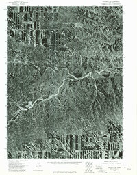
 1973 Camp Clarke 3 SE1975 Print · USGSThe ranching and farming landscape of the Nebraska Panhandle comes into sharp focus during the early 1970s. Trace the rural crossroads at Redington or follow the waters of Pumpkin Creek and Lawrence Fork across the plains.
 - 1973 Map of Camp Clarke 3 SW, 1975 Print
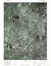
 1973 Camp Clarke 3 SW1975 Print · USGSWestern Nebraska agricultural lands and prairie breaks come into clear view during the early seventies. Genealogists and land researchers can trace exact property lines and farmstead locations near Pumpkin Creek and Hackberry Creek.
 - 1979 Map of Murray Lake SW
 1979 Murray Lake SW1979 Print · USGSBanner County ranching and energy exploration are captured here during the late seventies as local homesteads navigated the High Plains. Genealogists and researchers can locate family sites like Warner Ranch and Patton Ranch or trace Clay Springs Draw.
 - 1979 Map of Wright Gap
 1979 Wright Gap1979 Print · USGSThe Wildcat Hills straddle the Banner and Scotts Bluff county line in the late seventies, showing a landscape defined by ranching and irrigation. Family historians and researchers can locate Creighton Cem and trace early routes like Pumpkin Creek Road near Castle Rock.
 - 1979 Map of Wildcat Mountain
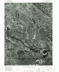
 1979 Wildcat Mountain1979 Print · USGSHigh plains ranching and energy extraction meet in the late 1970s along the Scotts Bluff and Banner County line. Trace local landmarks like Wildcat Mountain and Funnel Rock alongside the industrial footprint of the Henderson Oil Field.
 - 1979 Map of Harrisburg
 1979 Harrisburg1979 Print · USGSBanner County ranching and energy production are in focus during the late 1970s. Genealogists and historians can trace local landmarks like the Harrisburg Cem, the grid of Harrisburg, and the prominent Lovers Leap Butte.
 - 1979 Map of Indian Springs
 1979 Indian Springs1979 Print · USGSThe ranching country of the Nebraska Panhandle is documented here in the late seventies, showing the transition from level plains to high mesas. Researchers can trace family-named landmarks like Fayden Ranch and Van Pelt Ranch or locate the Wrights Community Hall.
 - 1979 Map of Singleton Ranch
 1979 Singleton Ranch1979 Print · USGSHigh plains ranching and energy extraction define this Banner County landscape during the late seventies. Researchers can trace land ownership and industry through landmarks like Singleton Ranch, Kirk Chapel, and the sprawling Oil Field.
 - 1979 Map of Gabe Rock
 1979 Gabe Rock1979 Print · USGSBanner County ranching and energy production are captured in the late 1970s. Researchers can trace family sites at Miles Ranch, the Gabe Rock Cem, and a solitary Grave amidst the Oil Field and Willow Creek drainage.
 - 1979 Map of Potter 2 NE
 1979 Potter 2 NE1979 Print · USGSThe Nebraska panhandle in the late seventies reveals an active landscape of resource extraction and aviation. Researchers can trace the development of the local Oil Field and find landmarks like the Mayer Landing Strip and Lawrence Fork.2 unique versions available
 - 1979 Map of Redington
 1979 Redington1979 Print · USGSThe high plains of Morrill County are captured here in the late seventies as the regional oil industry expanded across the ranchlands. Genealogists and historians can locate the community of Redington, the Schuler-Olsen Landing Strip, and landmarks like Twin Mounds.2 unique versions available
 - 1979 Map of Kimball 2 NE
 1979 Kimball 2 NE1979 Print · USGSThe Western Nebraska high plains are shown during a peak of energy production in the late seventies. Genealogists and historians can trace the industrial footprint of the Oil Field and scattered Oil Wells across the Banner Co and Kimball Co line.2 unique versions available
Showing maps 1-25 of 30
Top cities of Banner County
Frequently asked questions
- What are the different types of historical maps available for Banner County?
- What is the oldest map of Banner County?
- Where can I purchase historical maps of Banner County for my home or office?
- Where can I download high-res historical maps of Banner County?
- Are there historical topographic maps available for Banner County?
- Is there historical aerial imagery available for Banner County?
- Where are historical maps of Banner County sourced from?