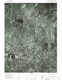
1973 Map of Scotts Bluff 3 SW
USGS Topo · Published 1975About this map
Long Canyon dominates the central drainage pattern of this Nebraska landscape, cutting a deep path southward through the high plains. This orthophoto quadrangle, based on aerial photography from May 1973, reveals a stark contrast between the natural erosion of the badlands and the highly structured human imprint of center-pivot irrigation and strip cropping. To the west, the winding recesses of Bull Canyon create a complex network of shadows and ridges. The imagery provides an authentic look at mid-century agricultural practices in Banner County, where the geometric precision of tilled fields abruptly meets the irregular, weathered terrain of the canyon breaks. This document allows researchers to study the exact footprint of homesteads and ranching roads at a time when the Western Nebraska agricultural landscape was undergoing significant modernization.
Find a feature on this map
2 named features on this map. Tap any name to fly to it.
Don’t see what you’re looking for? This feature index may not catch every label — zoom into the map to look around manually.
Map Details
Editions of this 1973 Scotts Bluff 3 SW Map
This is the sole edition of this map. No revisions or reprints were ever made.
Other maps of this area

1898 · Scotts Bluff
USGS Topo · 1:125,000

1899 · Goshen Hole
USGS Topo · 1:125,000

1954 · Scottsbluff
USGS Topo · 1:250,000

1954 · Cheyenne
USGS Topo · 1:250,000

1958 · Cheyenne
USGS Topo · 1:250,000

1958 · Scottsbluff
USGS Topo · 1:250,000

1960 · Tremain
USGS Topo · 1:24,000

1960 · Mc Compsey Pass
USGS Topo · 1:24,000

1960 · Murray Lake
USGS Topo · 1:24,000

1973 · Kimball 2 NE
USGS Topo · 1:24,000