
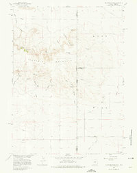
1960 Map of Mc Compsey Pass
USGS Topo · Published 1962About this map
Sixty Six Mountain dominates this high-plains landscape where the Wyoming and Nebraska state line bisects a network of canyons and draws. Surveyed in 1960, the area shows a clear reliance on isolated water sources for ranching, with numerous named points such as Huntington Springs, Mc Compsey Spring, and Boulder Spring punctuating the arid terrain. The map captures the livestock-driven economy of the era, marked by features like Bull Pasture Spring and the Spahr Ranch in the southeast corner.
Find a feature on this map
31 named features on this map. Tap any name to fly to it.
Don’t see what you’re looking for? This feature index may not catch every label — zoom into the map to look around manually.
Map Details
Editions of this 1960 Mc Compsey Pass Map
3 editions found
Other maps of this area

1898 · Scotts Bluff
USGS Topo · 1:125,000

1899 · Goshen Hole
USGS Topo · 1:125,000

1954 · Scottsbluff
USGS Topo · 1:250,000

1954 · Cheyenne
USGS Topo · 1:250,000

1958 · Cheyenne
USGS Topo · 1:250,000

1958 · Scottsbluff
USGS Topo · 1:250,000

1960 · Tremain
USGS Topo · 1:24,000

1960 · Petsch Reservoir
USGS Topo · 1:24,000

1960 · Stegall
USGS Topo · 1:24,000

1960 · La Grange
USGS Topo · 1:24,000