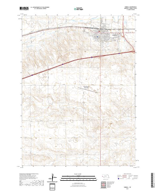
2021 Map of Kimball
USGS Topo · Published 2021About this map
Kimball serves as the central hub of this High Plains landscape, defined by a grid of agricultural section lines and vital water management systems. The town is anchored by the Kimball County Courthouse and a detailed street network including E Front St and S High School St, illustrating its role as a regional seat. The natural course of Lodgepole Cr is supplemented by the engineered Kimball Canal, reflecting the critical importance of irrigation and water rights in western Nebraska's ranching and farming economy. To the south, the Kimball Municipal Airport/Robert E Arraj Field occupies a prominent position on the open plains. This survey captures a moment of modern continuity in the Nebraska panhandle, where the intersection of interstate transport, aviation, and traditional water infrastructure maintains the settlement's viability.
Find a feature on this map
54 named features on this map. Tap any name to fly to it.
Don’t see what you’re looking for? This feature index may not catch every label — zoom into the map to look around manually.
Map Details
Editions of this 2021 Kimball Map
This is the sole edition of this map. No revisions or reprints were ever made.
Other maps of this area

1954 · Scottsbluff
USGS Topo · 1:250,000

1958 · Scottsbluff
USGS Topo · 1:250,000

1972 · Owasco
USGS Topo · 1:24,000

1972 · Kimball SE
USGS Topo · 1:24,000

1972 · Kimball SW
USGS Topo · 1:24,000

1972 · Kimball
USGS Topo · 1:24,000

1972 · Bushnell SE
USGS Topo · 1:24,000

1972 · Oliver Reservoir
USGS Topo · 1:24,000

1973 · Kimball 2 SE
USGS Topo · 1:24,000

1973 · Kimball 1 SE
USGS Topo · 1:24,000