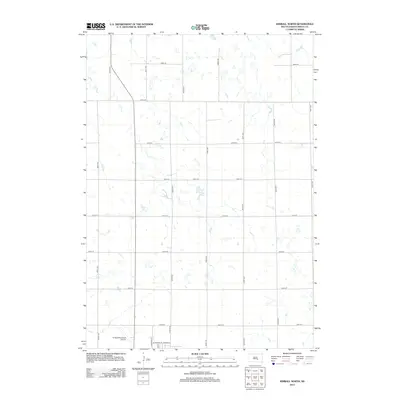
2012 Map of Kimball North
USGS Topo · Published 2012About this map
Kimball Municipal Airport anchors the southern edge of this landscape in Brule County, serving as a primary landmark at the northern fringe of the local community. The terrain is defined by a grid-like network of rural roads, including 360th Ave and 243rd St, which segment the agricultural prairie into precise sections. This arrangement reflects the long-standing land division patterns of South Dakota, where transportation routes such as 364th Ave and 250th St provide the backbone for rural connectivity. Within this orderly system, natural variations like Sobek Lake and numerous unnamed smaller basins punctuate the topography. Near the town center, specific streets like N Babcock St and Votman St delineate the transition from open range to municipal development, providing a clear view of the area's layout in the early 21st century.
Find a feature on this map
21 named features on this map. Tap any name to fly to it.
Don’t see what you’re looking for? This feature index may not catch every label — zoom into the map to look around manually.
Map Details
Editions of this 2012 Kimball North Map
This is the sole edition of this map. No revisions or reprints were ever made.
Other maps of this area

1941 · Pukwana
USGS Topo · 1:62,500

1941 · Kimball North
USGS Topo · 1:62,500

1951 · Pukwana
USGS Topo · 1:62,500

1951 · Kimball North
USGS Topo · 1:62,500

1955 · Mitchell
USGS Topo · 1:250,000

1959 · Mitchell
USGS Topo · 1:250,000

1979 · Bijou Hills NE
USGS Topo · 1:24,000

1979 · Platte Lake
USGS Topo · 1:24,000

1979 · Kimball South
USGS Topo · 1:24,000
1982 · Kimball North
USGS Topo · 1:25,000