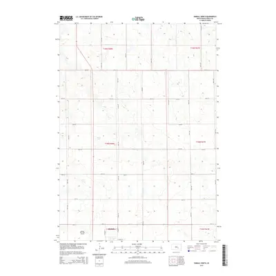
2015 Map of Kimball North
USGS Topo · Published 2015About this map
Kimball sits at the southern edge of this Missouri Plateau landscape, where the town's street grid begins to give way to the expansive agricultural section lines of Brule County. The northern outskirts are defined by the Kimball Municipal Airport and a network of precisely gridded roads such as N Babcock St and E Willis St. Small depressions and prairie potholes dot the terrain, with Sobek Lake serving as a prominent water feature amid the rolling elevations of townships t104n r68w and t105n r68w. This 2015 survey illustrates the enduring township and range system, showing how modern infrastructure like N Truck St integrates with the long-established rural corridors of 247th St and 360th Ave.
Find a feature on this map
25 named features on this map. Tap any name to fly to it.
Don’t see what you’re looking for? This feature index may not catch every label — zoom into the map to look around manually.
Map Details
Editions of this 2015 Kimball North Map
This is the sole edition of this map. No revisions or reprints were ever made.
Other maps of this area

1941 · Pukwana
USGS Topo · 1:62,500

1941 · Kimball North
USGS Topo · 1:62,500

1951 · Pukwana
USGS Topo · 1:62,500

1951 · Kimball North
USGS Topo · 1:62,500

1955 · Mitchell
USGS Topo · 1:250,000

1959 · Mitchell
USGS Topo · 1:250,000

1979 · Bijou Hills NE
USGS Topo · 1:24,000

1979 · Platte Lake
USGS Topo · 1:24,000

1979 · Kimball South
USGS Topo · 1:24,000
1982 · Kimball North
USGS Topo · 1:25,000