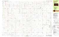
1982 Map of Kimball North
USGS Topo · Published 1983About this map
The town of Kimball and its northern surroundings are detailed in this early 1980s topographic study, illustrating the agricultural and conservation character of Brule and Aurora counties. The landscape is defined by a series of townships including Lyon, Polummer, Patten, and Waldro, characterized by a grid of rural roads and scattered farmsteads. Significant land is dedicated to conservation, notably the National Waterfowl Production Area and the Humphries Slough State Game Production Area, which protect the wetland habitats surrounding Willow Lake and White Lake. Infrastructure like the Municipal Airport near the town center and scattered Gravel Pits indicate the local economy, while Sobek Lake and Wilson Dam provide localized water management in this prairie environment.
Find a feature on this map
16 named features on this map. Tap any name to fly to it.
Don’t see what you’re looking for? This feature index may not catch every label — zoom into the map to look around manually.
Map Details
Editions of this 1982 Kimball North Map
This is the sole edition of this map. No revisions or reprints were ever made.
Other maps of this area

1941 · Pukwana
USGS Topo · 1:62,500

1941 · Kimball North
USGS Topo · 1:62,500

1942 · Crow Lake
USGS Topo · 1:62,500

1951 · Pukwana
USGS Topo · 1:62,500

1951 · Kimball North
USGS Topo · 1:62,500

1955 · Mitchell
USGS Topo · 1:250,000

1959 · Mitchell
USGS Topo · 1:250,000

1979 · Bijou Hills NE
USGS Topo · 1:24,000

1979 · White Lake
USGS Topo · 1:24,000

1979 · Platte Lake
USGS Topo · 1:24,000
Featured Places
- Kimball, Kimball Township
- Plainfield Township, SD
- Plummer Township, SD
- Waldro Township, SD
- Willow Lake Township, SD