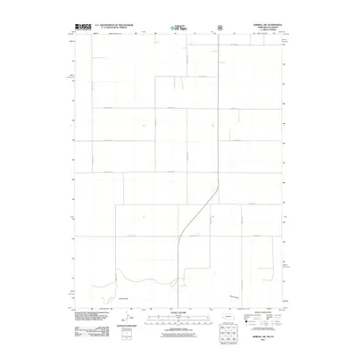
2011 Map of Kimball SW
USGS Topo · Published 2011About this map
Sidney Draw meanders across the southern portion of this high-plains landscape, marking the primary topographical break in an otherwise orderly grid of rural transport. The area is defined by its strict adherence to the Public Land Survey System, where a network of section-line roads like County Rd-18 and County Rd-33 facilitate movement across the agricultural expanse. The lack of concentrated settlements or commercial centers highlights the purely rural and ranching character of this region along the border of Colorado and Nebraska in the early 21st century. While modern in its production, the map documents the enduring skeleton of western expansion—a landscape where property boundaries and county routes such as County Rd-6 and County Rd-39 dictate the human footprint. Researchers can trace the subtle drainage patterns of the draw against the rigid geometry of the county road system.
Find a feature on this map
14 named features on this map. Tap any name to fly to it.
Don’t see what you’re looking for? This feature index may not catch every label — zoom into the map to look around manually.
Map Details
Editions of this 2011 Kimball SW Map
This is the sole edition of this map. No revisions or reprints were ever made.
Other maps of this area

1954 · Sterling
USGS Topo · 1:250,000

1954 · Scottsbluff
USGS Topo · 1:250,000

1958 · Scottsbluff
USGS Topo · 1:250,000

1958 · Sterling
USGS Topo · 1:250,000

1972 · Owasco
USGS Topo · 1:24,000

1972 · Kimball SE
USGS Topo · 1:24,000

1972 · Kimball SW
USGS Topo · 1:24,000

1972 · Kimball
USGS Topo · 1:24,000

1972 · Bushnell SE
USGS Topo · 1:24,000

1972 · Oliver Reservoir
USGS Topo · 1:24,000