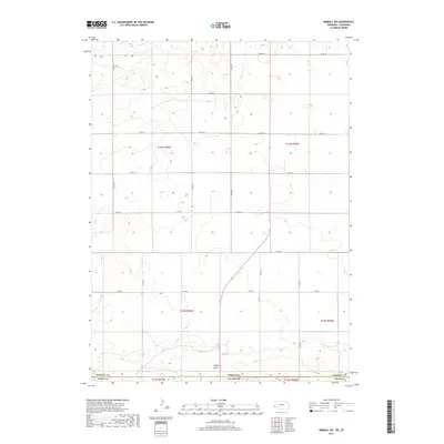
2017 Map of Kimball SW
USGS Topo · Published 2017About this map
Sidney Draw cuts through this high-plains landscape where the Nebraska-Colorado border meets. The terrain is defined by the agricultural grid and the transition between Kimball Co and Weld Co. Located just south of the Nebraska line, this area is crisscrossed by a systematic network of county roads, including Co Rd 33, Co Rd 18, and Co Rd 6, which facilitate movement across the sprawling township and range sections like t12n r56w. The geography is characteristic of the rural borderlands, showing the drainage patterns and the precise surveying lines that have governed land use in the region for generations.
Find a feature on this map
23 named features on this map. Tap any name to fly to it.
Don’t see what you’re looking for? This feature index may not catch every label — zoom into the map to look around manually.
Map Details
Editions of this 2017 Kimball SW Map
This is the sole edition of this map. No revisions or reprints were ever made.
Other maps of this area

1954 · Sterling
USGS Topo · 1:250,000

1954 · Scottsbluff
USGS Topo · 1:250,000

1958 · Scottsbluff
USGS Topo · 1:250,000

1958 · Sterling
USGS Topo · 1:250,000

1972 · Owasco
USGS Topo · 1:24,000

1972 · Kimball SE
USGS Topo · 1:24,000

1972 · Kimball SW
USGS Topo · 1:24,000

1972 · Kimball
USGS Topo · 1:24,000

1972 · Bushnell SE
USGS Topo · 1:24,000

1972 · Oliver Reservoir
USGS Topo · 1:24,000