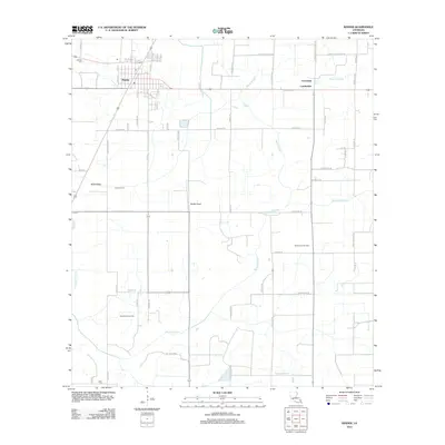
2012 Map of Kinder
USGS Topo · Published 2012About this map
Kinder serves as the primary hub in this Allen Parish landscape, where the town’s grid meets a complex network of waterways and energy infrastructure. The map reveals a transition from organized municipal streets like Benard Ave and 1st Ave to a surrounding rural expanse defined by agricultural irrigation and natural drainage. The Kinder Canal and Kinder Ditch illustrate the engineered management of the land, while the wandering path of Bayou Serpent cuts across the terrain toward settlements like Lauderdale and Coverdale. Local industry is anchored by the North Edna Oil Field and West Edna Gas Field, highlighting the region's reliance on natural resources. Genealogists will find value in the precise locations of the McGee Cem and LaBleu Cem, which are situated at the margins of the settled areas.
Find a feature on this map
61 named features on this map. Tap any name to fly to it.
Don’t see what you’re looking for? This feature index may not catch every label — zoom into the map to look around manually.
Map Details
Editions of this 2012 Kinder Map
This is the sole edition of this map. No revisions or reprints were ever made.
Other maps of this area

1947 · Kinder
USGS Topo · 1:31,680

1947 · Fenton
USGS Topo · 1:31,680

1947 · Oberlin
USGS Topo · 1:31,680

1947 · Pine Island
USGS Topo · 1:31,680

1947 · Le Blanc
USGS Topo · 1:31,680

1947 · Elton
USGS Topo · 1:31,680

1947 · Edna
USGS Topo · 1:31,680

1947 · Hathaway
USGS Topo · 1:31,680

1949 · Bayou Blue
USGS Topo · 1:31,680

1950 · Fenton
USGS Topo · 1:31,680