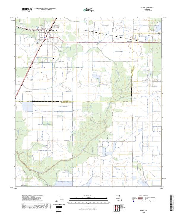
2024 Map of Kinder
USGS Topo · Published 2024About this map
Kinder serves as the primary hub of this Southwest Louisiana landscape, where the town's residential grid transitions into a vast network of drainage and irrigation infrastructure essential to the local prairie. The Kinder Canal and Kinder Ditch illustrate the area's agricultural engineering, cutting across the landscape to manage the flow toward Bayou Serpent and Gum Bayou. This system supports the surrounding rural communities of Lauderdale, Coverdale, and Fontenot, which are linked by a patchwork of parish roads named for local families, such as Guillory Rd and Martin Rd.
Find a feature on this map
79 named features on this map. Tap any name to fly to it.
Don’t see what you’re looking for? This feature index may not catch every label — zoom into the map to look around manually.
Map Details
Editions of this 2024 Kinder Map
This is the sole edition of this map. No revisions or reprints were ever made.
Other maps of this area

1947 · Kinder
USGS Topo · 1:31,680

1947 · Fenton
USGS Topo · 1:31,680

1947 · Oberlin
USGS Topo · 1:31,680

1947 · Pine Island
USGS Topo · 1:31,680

1947 · Le Blanc
USGS Topo · 1:31,680

1947 · Elton
USGS Topo · 1:31,680

1947 · Edna
USGS Topo · 1:31,680

1947 · Hathaway
USGS Topo · 1:31,680

1949 · Bayou Blue
USGS Topo · 1:31,680

1950 · Fenton
USGS Topo · 1:31,680