
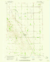
1959 Map of Kindred
USGS Topo · Published 1959About this map
Agricultural life in the Red River Valley defines this late-1950s landscape, where a dense network of township lines and section roads organizes the prairie. The Great Northern and Pacific Northern railroads intersect at Davenport, which serves as a central hub for the surrounding townships of Addison and Davenport. To the south, the town of Kindred sits near a sharp bend in the Sheyenne River, featuring local landmarks like Hamry Landing Field and a dedicated sewage disposal area.
Find a feature on this map
18 named features on this map. Tap any name to fly to it.
Don’t see what you’re looking for? This feature index may not catch every label — zoom into the map to look around manually.
Map Details
Editions of this 1959 Kindred Map
This is the sole edition of this map. No revisions or reprints were ever made.
Other maps of this area

1895 · Fargo
USGS Topo · 1:125,000

1895 · Casselton
USGS Topo · 1:125,000

1897 · Fargo
USGS Topo · 1:125,000

1897 · Casselton
USGS Topo · 1:125,000

1953 · Fargo
USGS Topo · 1:250,000

1956 · Fargo
USGS Topo · 1:250,000

1959 · Leonard
USGS Topo · 1:24,000

1959 · South West Fargo
USGS Topo · 1:24,000
1959 · Walcott
USGS Topo · 1:24,000
1959 · Norman
USGS Topo · 1:24,000