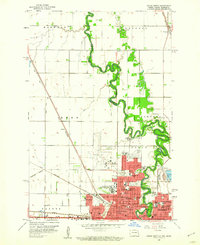
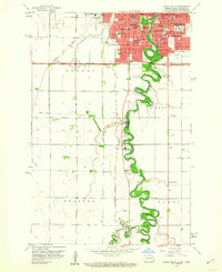
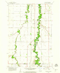
1959 Map of South West Fargo
USGS Topo · Published 1960About this map
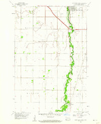
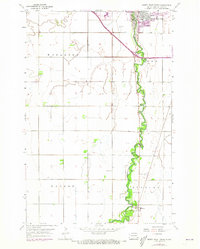
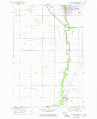
The Sheyenne River meanders heavily through this Red River Valley landscape, its tightly looped oxbows defining the geography between the townships of Mapleton, Barnes, Warren, and Stanley. At the end of the 1950s, the region was in a period of transition as modern infrastructure began to bisect traditional prairie farmstead patterns. This shift is most evident in the corridor labeled Under Construction, where early interstate development was making its way toward South West Fargo.
Find a feature on this map
15 named features on this map. Tap any name to fly to it.
Don’t see what you’re looking for? This feature index may not catch every label — zoom into the map to look around manually.
Map Details
Editions of this 1959 South West Fargo Map
3 editions found
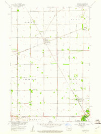
Other maps of this area

1895 · Fargo
USGS Topo · 1:125,000

1895 · Casselton
USGS Topo · 1:125,000

1897 · Fargo
USGS Topo · 1:125,000

1897 · Casselton
USGS Topo · 1:125,000

1953 · Fargo
USGS Topo · 1:250,000

1956 · Fargo
USGS Topo · 1:250,000
1959 · Kindred
USGS Topo · 1:24,000
1959 · Fargo North
USGS Topo · 1:24,000
1959 · Fargo South
USGS Topo · 1:24,000
1959 · Hickson
USGS Topo · 1:24,000