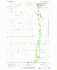
1959 Map of West Fargo South
USGS Topo · Published 1977About this map
The Sheyenne River meanders through the heart of this North Dakota landscape, anchoring the settlements of West Fargo and Horace during a period of mid-century development. While agricultural patterns dominate the townships of Mapleton, Barnes, Warren, and Stanley, the influence of modern infrastructure is evident in the presence of the Burlington Northern railroad and the West Fargo Landing Strip.
Find a feature on this map
15 named features on this map. Tap any name to fly to it.
Don’t see what you’re looking for? This feature index may not catch every label — zoom into the map to look around manually.
Map Details
Editions of this 1959 West Fargo South Map
3 editions found
Other maps of this area

1895 · Fargo
USGS Topo · 1:125,000

1895 · Casselton
USGS Topo · 1:125,000

1897 · Fargo
USGS Topo · 1:125,000

1897 · Casselton
USGS Topo · 1:125,000

1953 · Fargo
USGS Topo · 1:250,000

1956 · Fargo
USGS Topo · 1:250,000

1959 · Kindred
USGS Topo · 1:24,000

1959 · Fargo North
USGS Topo · 1:24,000

1959 · South West Fargo
USGS Topo · 1:24,000

1959 · Fargo South
USGS Topo · 1:24,000