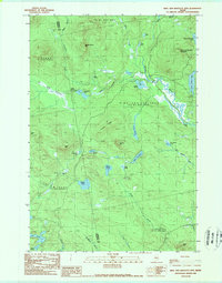
1989 Map of King and Bartlett Mtn
USGS Topo · Published 1989About this map
Kibby Kamp sits at the intersection of a vast network of watercourses and timbered slopes in the Maine woods of the late 1980s. The landscape is defined by the hydrography of Spencer Stream and Kibby Stream, which connect numerous bodies of water including King and Bartlett Lake and Little King Lake. This map captures a remote area of Somerset and Franklin counties where traditional land use is evidenced by a Gravel Pit, a Radio Tower, and several designated Campsites. The presence of Spencer Dam suggests the historical management of these waterways for logging or power. Topographically, the region is anchored by King and Bartlett Mountain and Spotted Spruce Mtn, with smaller peaks like Farm Hill and Antler Hill rising above the surrounding bogs and ponds, such as Joe Pokum Bog.
Find a feature on this map
43 named features on this map. Tap any name to fly to it.
Don’t see what you’re looking for? This feature index may not catch every label — zoom into the map to look around manually.
Map Details
Editions of this 1989 King and Bartlett Mtn Map
2 editions found
Other maps of this area

1928 · Chain Lakes
USGS Topo · 1:48,000

1928 · Spencer
USGS Topo · 1:48,000

1928 · Stratton
USGS Topo · 1:48,000

1932 · Stratton
USGS Topo · 1:62,500

1932 · Kennebago Lake
USGS Topo · 1:48,000

1932 · Spencer
USGS Topo · 1:62,500

1932 · Chain Lakes
USGS Topo · 1:62,500

1935 · Kennebago Lake
USGS Topo · 1:62,500

1935 · Chain Lakes
USGS Topo · 1:62,500

1936 · Kennebago Lake
USGS Topo · 1:62,500
Featured Places
- Flagstaff Township, ME
- Haynestown Township, ME
- Kibby Township, ME
- Jim Pond Township, ME
- King & Bartlett Township, ME