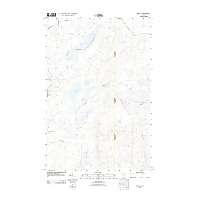
2013 Map of King Lake
USGS Topo · Published 2013About this map
Pequaywan Lookout Tower stands as a prominent sentinel over a landscape defined by an intricate network of glacial lakes and wetlands in this 2013 survey of the Arrowhead region. The map reveals a high density of water bodies, from the central expanse of King Lake and Grande Lake to the more secluded Kookoosh Lake and Ruth Lake. This area, split by the boundary between St. Louis Co and Lake Co, shows a transition from managed forest roads to more established routes like Pequaywan Lake Rd. The presence of the Drummond Grade and Old Drummond Rd suggests a history tied to the timber industry, while the headwaters of the W Br Knife River and Knife River drain the southern marshes. Small, scattered lakes like Sawmill Lake and Pigeon Lake offer a detailed look at the local topography before it reaches the North Shore highlands.
Find a feature on this map
43 named features on this map. Tap any name to fly to it.
Don’t see what you’re looking for? This feature index may not catch every label — zoom into the map to look around manually.
Map Details
Editions of this 2013 King Lake Map
This is the sole edition of this map. No revisions or reprints were ever made.
Other maps of this area

1953 · Whyte
USGS Topo · 1:62,500

1954 · Barrs Lake
USGS Topo · 1:24,000

1954 · Mc Carthy Creek
USGS Topo · 1:24,000

1954 · Two Harbors
USGS Topo · 1:250,000

1956 · Pequaywan Lake
USGS Topo · 1:24,000

1956 · King Lake
USGS Topo · 1:24,000

1957 · Two Harbors
USGS Topo · 1:250,000

1957 · Two Harbors
USGS Topo · 1:62,500

1957 · Two Harbors
USGS Topo · 1:24,000

1957 · Brimson
USGS Topo · 1:62,500