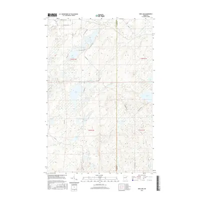
2016 Map of King Lake
USGS Topo · Published 2016About this map
King Lake and its surrounding wetlands anchor this 2016 survey of the boreal landscape along the border of St. Louis and Lake counties. The area is defined by a dense network of freshwater bodies, including Stewart Lake, Grande Lake, and Sawmill Lake, which are interconnected by drainages like Coyote Cr and the headwaters of the Knife River. This map illustrates the transition from primitive truck trails to established local routes, such as Pequaywan Lake Rd and the Drummond Grade, which traverse the undulating terrain and various marshes. The drainage patterns, particularly the West Branch Knife River in the south, highlight the hydrology of the Arrowhead region. Subtle human footprints are seen in the naming of remote access points like Stockhooh Way and the scattered lakefront developments along Little Stone Lake.
Find a feature on this map
51 named features on this map. Tap any name to fly to it.
Don’t see what you’re looking for? This feature index may not catch every label — zoom into the map to look around manually.
Map Details
Editions of this 2016 King Lake Map
This is the sole edition of this map. No revisions or reprints were ever made.
Other maps of this area

1953 · Whyte
USGS Topo · 1:62,500

1954 · Barrs Lake
USGS Topo · 1:24,000

1954 · Mc Carthy Creek
USGS Topo · 1:24,000

1954 · Two Harbors
USGS Topo · 1:250,000

1956 · Pequaywan Lake
USGS Topo · 1:24,000

1956 · King Lake
USGS Topo · 1:24,000

1957 · Two Harbors
USGS Topo · 1:250,000

1957 · Two Harbors
USGS Topo · 1:62,500

1957 · Two Harbors
USGS Topo · 1:24,000

1957 · Brimson
USGS Topo · 1:62,500