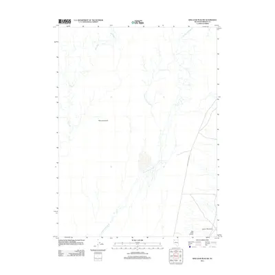
2011 Map of King Lear Peak NW
USGS Topo · Published 2011About this map
Black Rock Desert dominates this arid landscape in northwestern Nevada, where the drainage patterns of the Quinn River and the braided channels of Jackson Creek Slough illustrate the complex hydrology of the high desert basin. The map reveals the stark transition between the flat alkaline playa and the rising foothills of the Jackson Mountains to the southeast. Human presence is minimal in this 2011 survey, marked primarily by Jackson Creek Ranch Rd and the opening of Red Butte Canyon. This sheet is particularly useful for understanding the exact watercourses of the Jackson-Creek Slough as they interact with the desert floor, providing a precise record of the regional geography before seasonal or long-term shifts in the river's path.
Find a feature on this map
7 named features on this map. Tap any name to fly to it.
Don’t see what you’re looking for? This feature index may not catch every label — zoom into the map to look around manually.
Map Details
Editions of this 2011 King Lear Peak NW Map
This is the sole edition of this map. No revisions or reprints were ever made.
Other maps of this area

1886 · Disaster
USGS Topo · 1:250,000

1893 · Disaster
USGS Topo · 1:250,000

1954 · Vya
USGS Topo · 1:250,000

1958 · Vya
USGS Topo · 1:250,000

1962 · Vya
USGS Topo · 1:250,000

1966 · King Lear Peak
USGS Topo · 1:62,500

1972 · Pinto Mountain
USGS Topo · 1:24,000

1972 · Hobo Canyon
USGS Topo · 1:24,000
1972 · Leonard Cr. Slough South
USGS Topo · 1:24,000
1979 · Crowbar Spring
USGS Topo · 1:24,000