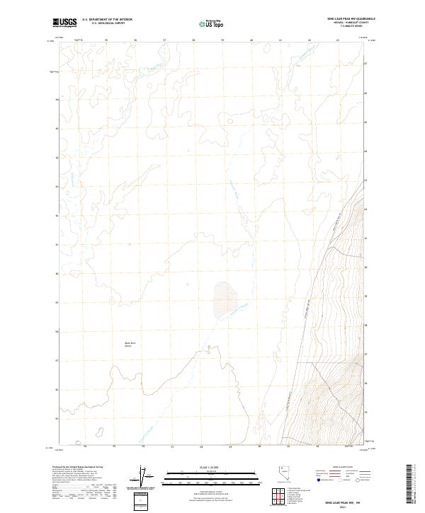
2021 Map of King Lear Peak NW
USGS Topo · Published 2021About this map
The Black Rock Desert landscape is defined by its expansive, flat alkaline plains where the Quinn River meanders in a series of branching channels before dissipating into the arid basin. This 2021 survey illustrates the complex hydrology of the region, featuring the seasonal Jackson Cr Slough as it threads through the low-lying terrain. The map captures a high degree of isolation, with human infrastructure represented primarily by the lone corridor of Jackson Creek Ranch Rd. This route serves as the primary land link across the basin's edge, connecting the vast salt flats to the rising elevations of the surrounding mountains. The shifting nature of the desert's water systems is visible in the detailed topographic contours, which show subtle depressions where water collects during infrequent runoff events.
Find a feature on this map
12 named features on this map. Tap any name to fly to it.
Don’t see what you’re looking for? This feature index may not catch every label — zoom into the map to look around manually.
Map Details
Editions of this 2021 King Lear Peak NW Map
This is the sole edition of this map. No revisions or reprints were ever made.
Other maps of this area

1886 · Disaster
USGS Topo · 1:250,000

1893 · Disaster
USGS Topo · 1:250,000

1954 · Vya
USGS Topo · 1:250,000

1958 · Vya
USGS Topo · 1:250,000

1962 · Vya
USGS Topo · 1:250,000

1966 · King Lear Peak
USGS Topo · 1:62,500

1972 · Pinto Mountain
USGS Topo · 1:24,000

1972 · Hobo Canyon
USGS Topo · 1:24,000
1972 · Leonard Cr. Slough South
USGS Topo · 1:24,000
1979 · Crowbar Spring
USGS Topo · 1:24,000