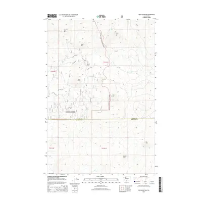
2014 Map of King Mountain
USGS Topo · Published 2014About this map
A G Aiken Lava Bed dominates the northwestern portion of this landscape, illustrating the volcanic history of the southern Washington Cascades. The terrain is marked by a sequence of prominent peaks, including King Mtn, Snowplow Mtn, and Snipes Mtn, which define the topography within the Gifford Pinchot National Forest. This high-altitude region, spanning the border of Yakima and Klickitat counties, shows a complex network of forest development roads such as Nat For Dev Rd 82 and NFD 190 Rd, which provide access to isolated points like Mud Spring. The drainage patterns of Gotchen Cr and Bird Cr cut through a series of volcanic features, including Bunnell Butte and Smith Butte, showing the intersection of geological formations and the timber management infrastructure of the early 21st century.
Find a feature on this map
26 named features on this map. Tap any name to fly to it.
Don’t see what you’re looking for? This feature index may not catch every label — zoom into the map to look around manually.
Map Details
Editions of this 2014 King Mountain Map
This is the sole edition of this map. No revisions or reprints were ever made.
Other maps of this area

1904 · Mount Adams
USGS Topo · 1:125,000

1907 · Mount Adams
USGS Topo · 1:125,000

1926 · Steamboat Mtn
USGS Topo · 1:125,000

1926 · Hood River
USGS Topo · 1:125,000

1929 · Hood River
USGS Topo · 1:125,000

1931 · Steamboat Mtn
USGS Topo · 1:125,000

1934 · The Dalles
USGS Topo · 1:125,000

1950 · Yakima
USGS Topo · 1:250,000

1953 · The Dalles
USGS Topo · 1:250,000

1956 · The Dalles
USGS Topo · 1:250,000