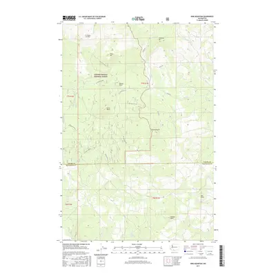
2017 Map of King Mountain
USGS Topo · Published 2017About this map
Gifford Pinchot National Forest dominates the high-altitude landscape of this southern Washington region, where volcanic geology is the defining characteristic of the terrain. The northern reaches are marked by the A G Aiken Lava Bed, a significant geological feature near Snipes Mtn and Snowplow Mtn. The quadrangle spans the border of Yakima and Klickitat counties, showing a network of specialized forestry roads like Nat For Dev RD 82 and Nat For Dev RD 150 that navigate between prominent peaks such as Bunnell Butte and King Mountain. To the south, the landscape transitions towards the more accessible areas of Meadow Butte and the headwaters of Bird Cr, illustrating the rugged, high-elevation road systems utilized for modern forest management and resource access.
Find a feature on this map
30 named features on this map. Tap any name to fly to it.
Don’t see what you’re looking for? This feature index may not catch every label — zoom into the map to look around manually.
Map Details
Editions of this 2017 King Mountain Map
This is the sole edition of this map. No revisions or reprints were ever made.
Other maps of this area

1904 · Mount Adams
USGS Topo · 1:125,000

1907 · Mount Adams
USGS Topo · 1:125,000

1926 · Steamboat Mtn
USGS Topo · 1:125,000

1926 · Hood River
USGS Topo · 1:125,000

1929 · Hood River
USGS Topo · 1:125,000

1931 · Steamboat Mtn
USGS Topo · 1:125,000

1934 · The Dalles
USGS Topo · 1:125,000

1950 · Yakima
USGS Topo · 1:250,000

1953 · The Dalles
USGS Topo · 1:250,000

1956 · The Dalles
USGS Topo · 1:250,000