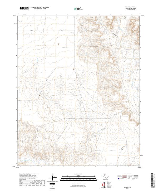
2022 Map of King SE
USGS Topo · Published 2022About this map
Rita Blanca Creek cuts through the high plains of the Texas Panhandle, carving a network of drainage channels that define the local topography. This portion of Hartley County is characterized by large-scale land divisions and an sparse road network including Ranch Rd 998, Bradshaw, and Co Rd N. The landscape is shaped by the movement of water through seasonal drainage systems like Cottonwood Draw and Cramer Creek, which feed into larger arteries like Punta de Agua Creek. These features illustrate the drainage patterns essential to cattle ranching operations in this arid region, where the terrain transitions from flat mesas into deeply etched draws. The map provides a clear look at the relationship between the few established roadways and the natural contours of the land in a relatively undeveloped corner of the state.
Find a feature on this map
7 named features on this map. Tap any name to fly to it.
Don’t see what you’re looking for? This feature index may not catch every label — zoom into the map to look around manually.
Map Details
Editions of this 2022 King SE Map
This is the sole edition of this map. No revisions or reprints were ever made.
Other maps of this area

1954 · Tucumcari
USGS Topo · 1:250,000

1958 · Tucumcari
USGS Topo · 1:250,000

1971 · Proctor Ranch
USGS Topo · 1:24,000

1971 · Channing NW
USGS Topo · 1:24,000

1971 · Pedarosa Camp
USGS Topo · 1:24,000

1972 · Hartley SW
USGS Topo · 1:24,000

1973 · Pardue Camp
USGS Topo · 1:24,000

1973 · King SW
USGS Topo · 1:24,000

1973 · Hartley
USGS Topo · 1:24,000

1973 · King
USGS Topo · 1:24,000