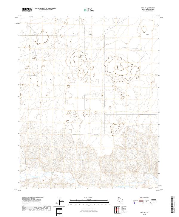
2022 Map of King SW
USGS Topo · Published 2022About this map
Punta de Agua Cr defines the southern portion of this high plains landscape in Hartley County. This terrain is characterized by broad, elevated flats that transition into the complex drainage patterns of the creek valley. Most of the area remains largely undeveloped, defined by a sparse grid of rural roads like Co Rd N and several large, rectilinear land parcels. The topographic contours reveal the subtle shifts in elevation that dictate the flow of water across this dry Texas landscape, providing an look at the physical geography of the region as it existed during the 2022 survey by the U.S. Geological Survey.
Find a feature on this map
2 named features on this map. Tap any name to fly to it.
Don’t see what you’re looking for? This feature index may not catch every label — zoom into the map to look around manually.
Map Details
Editions of this 2022 King SW Map
This is the sole edition of this map. No revisions or reprints were ever made.
Other maps of this area

1954 · Tucumcari
USGS Topo · 1:250,000

1958 · Tucumcari
USGS Topo · 1:250,000

1971 · Middle Water
USGS Topo · 1:24,000

1971 · Syndicate Hills
USGS Topo · 1:24,000

1971 · Proctor Ranch
USGS Topo · 1:24,000

1971 · Spring Creek Ranch
USGS Topo · 1:24,000

1971 · Pedarosa Camp
USGS Topo · 1:24,000

1973 · Pardue Camp
USGS Topo · 1:24,000

1973 · King SW
USGS Topo · 1:24,000

1973 · King
USGS Topo · 1:24,000