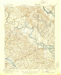
1920 Map of King William
USGS Topo · Published 1944About this map
The Pamunkey Indian Reservation sits along the meandering curves of the Pamunkey River, a focal point of this tidewater landscape during the early twentieth century. This region is defined by its intricate water networks, including the Mattaponi River and Chickahominy River, which served as vital corridors for local trade and transport. The map documents an economy rooted in small-scale milling and rural commerce, evidenced by numerous named sites like Dabneys Mill, Crumps Mill, and Pattersons Store.
Find a feature on this map
74 named features on this map. Tap any name to fly to it.
Don’t see what you’re looking for? This feature index may not catch every label — zoom into the map to look around manually.
Map Details
Editions of this 1920 King William Map
4 editions found

Other maps of this area

1894 · Bermuda Hundred
USGS Topo · 1:62,500

1894 · Richmond
USGS Topo · 1:62,500

1895 · Richmond
USGS Topo · 1:62,500

1917 · Toano
USGS Topo · 1:62,500

1918 · Charles City
USGS Topo · 1:62,500

1918 · Toano
USGS Topo · 1:62,500

1918 · Doswell
USGS Topo · 1:62,500

1918 · Tappahannock
USGS Topo · 1:62,500

1918 · Aylett
USGS Topo · 1:62,500

1919 · New Kent
USGS Topo · 1:62,500