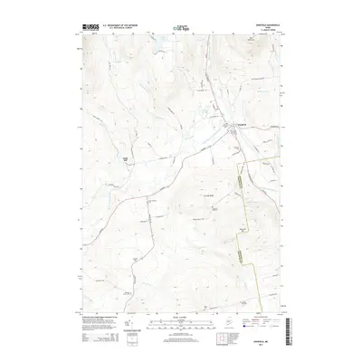
2014 Map of Kingfield
USGS Topo · Published 2014About this map
The Carrabassett River and its West Branch meet in the village of Kingfield, marking a landscape where river valleys dictate the placement of roads and industry. The presence of Soule Mill along Rapid Stream underscores a legacy of timber and milling that has long shaped this part of Franklin County. High ground is defined by Vose Mountain to the north and the sprawling Freeman Ridge to the south, which shelters the small settlement of North Freeman. For genealogists, the area is notably well-documented by its burial grounds, ranging from the central Riverside Cem and Sunnyside Cem in town to smaller family and community plots like Starbird Corner Cem, Allen Cem, and the Burbank Nile Cem located near the Somerset County line.
Find a feature on this map
75 named features on this map. Tap any name to fly to it.
Don’t see what you’re looking for? This feature index may not catch every label — zoom into the map to look around manually.
Map Details
Editions of this 2014 Kingfield Map
This is the sole edition of this map. No revisions or reprints were ever made.
Other maps of this area

1928 · Dead River
USGS Topo · 1:62,500

1928 · Stratton
USGS Topo · 1:48,000

1929 · Phillips
USGS Topo · 1:48,000

1930 · Kingfield
USGS Topo · 1:48,000

1931 · Dead River
USGS Topo · 1:48,000

1932 · Phillips
USGS Topo · 1:62,500

1932 · Stratton
USGS Topo · 1:62,500

1932 · Kingfield
USGS Topo · 1:62,500

1944 · Dead River
USGS Topo · 1:62,500

1949 · Jackman
USGS Topo · 1:250,000