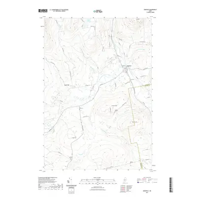
2021 Map of Kingfield
USGS Topo · Published 2021About this map
The Carrabassett River flows through the village of Kingfield, serving as the geographical heart of this Maine mountain community. This modern survey illustrates the rugged high-country landscape where the West Branch Carrabassett River meets the main stem, a confluence that historically anchored local industry and settlement patterns. To the west, the label for Soule Mill points to the area's timber and milling heritage, while the surrounding terrain is defined by prominent elevations such as Vose Mtn and Freeman Ridge. Numerous family-named cemeteries, including the North Freeman Cem, Starbird Corner Cem, and Burbank Nile Cem, are scattered across the quadrangle, offering invaluable data points for genealogists tracking early families in Franklin and Somerset counties. The transition from valley bottom roads like Salem Rd to higher elevations like Foster Hill highlights the enduring rural character of the region.
Find a feature on this map
70 named features on this map. Tap any name to fly to it.
Don’t see what you’re looking for? This feature index may not catch every label — zoom into the map to look around manually.
Map Details
Editions of this 2021 Kingfield Map
This is the sole edition of this map. No revisions or reprints were ever made.
Other maps of this area

1928 · Dead River
USGS Topo · 1:62,500

1928 · Stratton
USGS Topo · 1:48,000

1929 · Phillips
USGS Topo · 1:48,000

1930 · Kingfield
USGS Topo · 1:48,000

1931 · Dead River
USGS Topo · 1:48,000

1932 · Phillips
USGS Topo · 1:62,500

1932 · Stratton
USGS Topo · 1:62,500

1932 · Kingfield
USGS Topo · 1:62,500

1944 · Dead River
USGS Topo · 1:62,500

1949 · Jackman
USGS Topo · 1:250,000