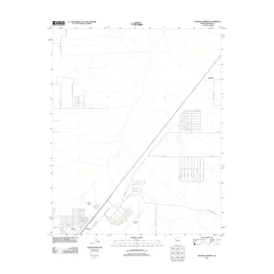
2011 Map of Kingman Airport
USGS Topo · Published 2011About this map
Kingman Airport serves as a central hub for the aviation and industrial development shown in this desert landscape of northwest Arizona. The map illustrates a growing suburban and industrial grid at the southern edge, where the settlements of Butler and Berry sit near the major airport facilities. North of this developed core, the terrain opens into a vast network of desert washes and widely spaced ranching landmarks such as Long Mountain Ranch.
Find a feature on this map
54 named features on this map. Tap any name to fly to it.
Don’t see what you’re looking for? This feature index may not catch every label — zoom into the map to look around manually.
Map Details
Editions of this 2011 Kingman Airport Map
This is the sole edition of this map. No revisions or reprints were ever made.
Other maps of this area

1886 · Diamond Creek
USGS Topo · 1:250,000

1886 · Camp Mohave
USGS Topo · 1:250,000

1892 · Diamond Creek
USGS Topo · 1:250,000

1892 · Camp Mohave
USGS Topo · 1:250,000

1939 · Chloride
USGS Topo · 1:48,000

1942 · Camp Mohave
USGS Topo · 1:250,000

1944 · Chloride
USGS Topo · 1:62,500

1947 · Kingman
USGS Topo · 1:250,000

1948 · Kingman
USGS Topo · 1:250,000

1948 · Williams
USGS Topo · 1:250,000