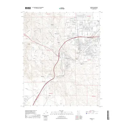
2018 Map of Kingman
USGS Topo · Published 2018About this map
Kingman serves as the focal point of this modern topographic study, where the residential and industrial expansion of the city meets the edge of the Mojave Desert. The map reveals a transition from the structured urban grid of the city and its neighborhoods like Getz to the specialized terrain of the west, including the distinctive geological formations of Monolith Gardens. Transportation corridors are a defining feature, with the heavy imprint of the Frontage roads and established routes such as Oatman Rd and Fort Beale Dr cutting through the desert landscape. To the west, the Cerbat Mountains rise sharply, accessed by a network of recreational paths including the Sidewinder Trail and Castle Rock Trail. Historical water sources like Beale Spring and Atlantic Spring are documented alongside more modern landmarks such as Mountain View Cem, providing a comprehensive look at the human and natural geography of Mohave County.
Find a feature on this map
54 named features on this map. Tap any name to fly to it.
Don’t see what you’re looking for? This feature index may not catch every label — zoom into the map to look around manually.
Map Details
Editions of this 2018 Kingman Map
This is the sole edition of this map. No revisions or reprints were ever made.
Other maps of this area

1886 · Diamond Creek
USGS Topo · 1:250,000

1886 · Camp Mohave
USGS Topo · 1:250,000

1892 · Diamond Creek
USGS Topo · 1:250,000

1892 · Camp Mohave
USGS Topo · 1:250,000

1939 · Chloride
USGS Topo · 1:48,000

1942 · Camp Mohave
USGS Topo · 1:250,000

1944 · Chloride
USGS Topo · 1:62,500

1947 · Kingman
USGS Topo · 1:250,000

1948 · Kingman
USGS Topo · 1:250,000

1948 · Williams
USGS Topo · 1:250,000