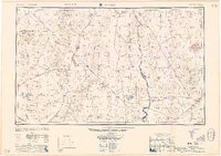
1958 Map of Kingman
USGS Topo · Published 1958About this map
Fort Mohave Indian Reservation and the winding course of the Colorado River anchor this 1950s survey of the tri-state borderlands. The map details a high-desert landscape defined by intense mineral exploration and the infrastructure of the Union Pacific and Atchison Topeka and Santa Fe railroads. Mining districts are heavily represented, including the Keystone Mine, Copper World Mine, and Red Cloud Mine, indicating the region's industrial priorities at mid-century. Small settlements like Oatman, Goldroad, and Searchlight serve as evidence of the area's gold and copper heritage. To the north, the Lake Mead National Recreational Area signals the growing importance of water management and leisure in the Mojave. The map also captures the early footprints of Bullhead City and Katherine along the river banks, showing the shift from hard-rock mining toward permanent riverside settlement.
Find a feature on this map
103 named features on this map. Tap any name to fly to it.
Don’t see what you’re looking for? This feature index may not catch every label — zoom into the map to look around manually.
Map Details
Editions of this 1958 Kingman Map
2 editions found

Other maps of this area

1886 · Diamond Creek
USGS Topo · 1:250,000

1886 · Camp Mohave
USGS Topo · 1:250,000

1886 · Saint Thomas
USGS Topo · 1:250,000

1886 · Mt. Trumbull
USGS Topo · 1:250,000

1892 · Diamond Creek
USGS Topo · 1:250,000

1892 · Mt. Trumbull
USGS Topo · 1:250,000

1892 · Camp Mohave
USGS Topo · 1:250,000

1893 · Saint Thomas
USGS Topo · 1:250,000

1903 · Needles
USGS Topo · 1:125,000

1904 · Needles Special
USGS Topo · 1:125,000