
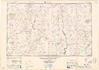
1958 Map of Kingman
USGS Topo · Published 1958About this map
Kingman and the high desert of the Colorado River valley are captured here just as the post-war era transformed the tri-state borderlands of Arizona, Nevada, and California. The map reveals a landscape defined by industrial history and transition, where the Atchison Topeka and Santa Fe railroad and historic Route 66 intersect with a century of hard-rock mining. Deep in the mountains, numerous operations such as the Potosi Mine, Sultan Mine, and Copper World Mine are noted, while the Searchlight Ferry still provides a vital crossing of the Colorado River before the full impact of modern bridging. North of the river, the Lake Mead National Recreational Area borders the growing hub of Boulder City. The settlement pattern follows the geography of the basins, from the Sacramento Valley to the Hualpai Valley, where remote outposts like Oatman, Chloride, and Goldroad reflect the area’s enduring reliance on mineral wealth.
Find a feature on this map
121 named features on this map. Tap any name to fly to it.
Don’t see what you’re looking for? This feature index may not catch every label — zoom into the map to look around manually.
Map Details
Editions of this 1958 Kingman Map
2 editions found
Other maps of this area

1886 · Diamond Creek
USGS Topo · 1:250,000

1886 · Camp Mohave
USGS Topo · 1:250,000

1886 · Saint Thomas
USGS Topo · 1:250,000

1886 · Mt. Trumbull
USGS Topo · 1:250,000

1892 · Diamond Creek
USGS Topo · 1:250,000

1892 · Mt. Trumbull
USGS Topo · 1:250,000

1892 · Camp Mohave
USGS Topo · 1:250,000

1893 · Saint Thomas
USGS Topo · 1:250,000

1903 · Needles
USGS Topo · 1:125,000

1904 · Needles Special
USGS Topo · 1:125,000