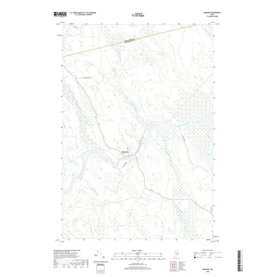
2018 Map of Kingman
USGS Topo · Published 2018About this map
Kingman sits at the heart of this landscape, positioned along the winding Mattawamkeag River near the junction of several significant tributaries. The terrain is defined by a dense network of waterways and wetlands, including the extensive Billy Doe Bog to the south and Mud Pond on the eastern edge. The map captures the meeting point of Aroostook and Penobscot counties, illustrating how local transportation followed the natural contours of the river valleys.
Find a feature on this map
20 named features on this map. Tap any name to fly to it.
Don’t see what you’re looking for? This feature index may not catch every label — zoom into the map to look around manually.
Map Details
Editions of this 2018 Kingman Map
This is the sole edition of this map. No revisions or reprints were ever made.
Other maps of this area

1920 · Winn
USGS Topo · 1:62,500

1931 · Springfield
USGS Topo · 1:48,000

1934 · Springfield
USGS Topo · 1:62,500

1940 · Mattawamkeag
USGS Topo · 1:62,500

1941 · Wytopitlock
USGS Topo · 1:62,500

1942 · Mattawamkeag
USGS Topo · 1:62,500

1943 · Wytopitlock
USGS Topo · 1:62,500

1954 · Millinocket
USGS Topo · 1:250,000

1958 · Millinocket
USGS Topo · 1:250,000

1960 · Millinocket
USGS Topo · 1:250,000