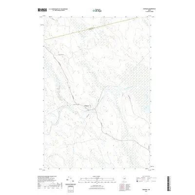
2021 Map of Kingman
USGS Topo · Published 2021About this map
Kingman sits at a strategic bend where several waterways converge in the northern Maine woods. This 2021 topographic record illustrates a landscape dominated by the winding course of the Mattawamkeag River, which is joined here by the Molunkus Stream and Crossuntic Stream. The settlement itself is concentrated near the river crossing, with Kingman Cem and a network of local roads like Lancaster Rd and Park St serving the community.
Find a feature on this map
20 named features on this map. Tap any name to fly to it.
Don’t see what you’re looking for? This feature index may not catch every label — zoom into the map to look around manually.
Map Details
Editions of this 2021 Kingman Map
This is the sole edition of this map. No revisions or reprints were ever made.
Other maps of this area

1920 · Winn
USGS Topo · 1:62,500

1931 · Springfield
USGS Topo · 1:48,000

1934 · Springfield
USGS Topo · 1:62,500

1940 · Mattawamkeag
USGS Topo · 1:62,500

1941 · Wytopitlock
USGS Topo · 1:62,500

1942 · Mattawamkeag
USGS Topo · 1:62,500

1943 · Wytopitlock
USGS Topo · 1:62,500

1954 · Millinocket
USGS Topo · 1:250,000

1958 · Millinocket
USGS Topo · 1:250,000

1960 · Millinocket
USGS Topo · 1:250,000