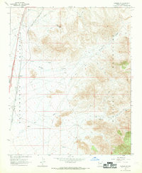
1967 Map of Kingman SE
USGS Topo · Published 1969About this map
The transition from the Sacramento Valley floor to the high slopes of the Hualapai Mountains defines this landscape southeast of Kingman. The Atchison Topeka and Santa Fe railroad corridor cuts across the valley floor, passing through the settlement of Griffith. This line historically supported the regional movement of goods and passengers, connecting the arid basin to larger market centers.
Find a feature on this map
17 named features on this map. Tap any name to fly to it.
Don’t see what you’re looking for? This feature index may not catch every label — zoom into the map to look around manually.
Map Details
Editions of this 1967 Kingman SE Map
3 editions found
Other maps of this area

1886 · Diamond Creek
USGS Topo · 1:250,000

1886 · Camp Mohave
USGS Topo · 1:250,000

1892 · Diamond Creek
USGS Topo · 1:250,000

1892 · Camp Mohave
USGS Topo · 1:250,000

1923 · Signal
USGS Topo · 1:250,000

1927 · Yucca
USGS Topo · 1:62,500

1929 · Yucca
USGS Topo · 1:62,500

1942 · Camp Mohave
USGS Topo · 1:250,000

1942 · Signal
USGS Topo · 1:250,000

1947 · Kingman
USGS Topo · 1:250,000