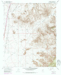
1967 Map of Kingman SE
USGS Topo · Published 1985About this map
The Atchison Topeka and Santa Fe railroad cuts a sharp north-south line through the western expanse of the Sacramento Valley, serving as the primary infrastructure for this arid region. The small settlement of Griffith sits along these tracks, positioned near the mouth of Shingle Wash. To the east, the landscape shifts dramatically as the foothills of the Hualapai Mountains rise, carved by drainage systems like Black Rock Canyon Wash and Walnut Creek.
Find a feature on this map
19 named features on this map. Tap any name to fly to it.
Don’t see what you’re looking for? This feature index may not catch every label — zoom into the map to look around manually.
Map Details
Editions of this 1967 Kingman SE Map
3 editions found
Other maps of this area

1886 · Diamond Creek
USGS Topo · 1:250,000

1886 · Camp Mohave
USGS Topo · 1:250,000

1892 · Diamond Creek
USGS Topo · 1:250,000

1892 · Camp Mohave
USGS Topo · 1:250,000

1923 · Signal
USGS Topo · 1:250,000

1927 · Yucca
USGS Topo · 1:62,500

1929 · Yucca
USGS Topo · 1:62,500

1942 · Camp Mohave
USGS Topo · 1:250,000

1942 · Signal
USGS Topo · 1:250,000

1947 · Kingman
USGS Topo · 1:250,000