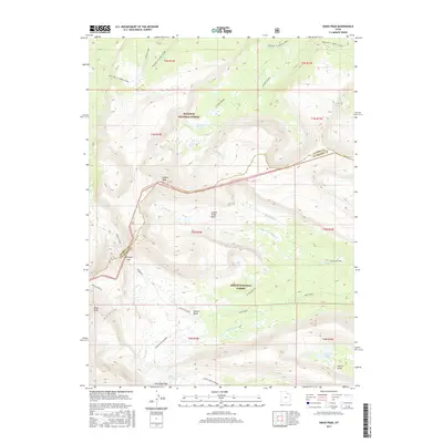
2017 Map of Kings Peak
USGS Topo · Published 2017About this map
Kings Peak and Gilbert Peak dominate this high-elevation landscape within the Wasatch National Forest and Ashley National Forest. This 2017 survey documents the critical drainage divides and glacial basins that define the Uinta Mountains, including the expansive Gilbert Creek Basin and Painter Basin. The network of alpine waterways is precisely mapped, from the headwaters of the Uinta River to secluded features like Milk Lake, Gilbert Lake, and Lake George Beard. Significant backcountry routes cross the high ridges, notably the Uinta Highline and Chain Lakes-Atwood trails, which intersect at strategic points like Gunsight Pass and Trail Rider Pass. The map illustrates the rugged transition between the North Slope, marked by Highline "A" (North Slope), and the southern basins, providing a detailed record of this alpine wilderness as it appeared in the early 21st century.
Find a feature on this map
32 named features on this map. Tap any name to fly to it.
Don’t see what you’re looking for? This feature index may not catch every label — zoom into the map to look around manually.
Map Details
Editions of this 2017 Kings Peak Map
This is the sole edition of this map. No revisions or reprints were ever made.
Other maps of this area

1885 · Uinta
USGS Topo · 1:250,000

1905 · Gilbert Peak
USGS Topo · 1:125,000

1906 · Gilbert Peak
USGS Topo · 1:125,000

1954 · Salt Lake City
USGS Topo · 1:250,000

1958 · Salt Lake City
USGS Topo · 1:250,000

1960 · Salt Lake City
USGS Topo · 1:250,000

1965 · Mount Emmons
USGS Topo · 1:24,000
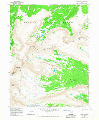
1965 · Kings Peak
USGS Topo · 1:24,000
1965 · Bollie Lake
USGS Topo · 1:24,000
1965 · Fox Lake
USGS Topo · 1:24,000