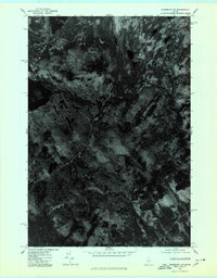
1975 Map of Kingsbury NW
USGS Topo · Published 1980About this map
Foss Hill Ridge and Crocker Hill dominate this orthophotograph of the Somerset County wilderness, captured during an aerial survey in the autumn of 1975. This particular map style emphasizes the raw texture of the Maine woods, showing the dense forest canopy and the intricate drainages that connect isolated water bodies. These remote lakes, including Spectacle Pond, Hedgehog Pond, and Palmer Pond, appear as dark ink-blots against the complex, variegated grays of the timberland. For those studying the evolution of land use and forestry in the region, the high-altitude photography provides a clear view of logging roads and natural clearings as they existed in the mid-1970s, before modern development or changing vegetation patterns altered the visible landscape.
Find a feature on this map
5 named features on this map. Tap any name to fly to it.
Don’t see what you’re looking for? This feature index may not catch every label — zoom into the map to look around manually.
Map Details
Editions of this 1975 Kingsbury NW Map
This is the sole edition of this map. No revisions or reprints were ever made.
Other maps of this area

1903 · Bingham
USGS Topo · 1:62,500

1905 · Bingham
USGS Topo · 1:62,500

1905 · The Forks
USGS Topo · 1:62,500

1907 · The Forks
USGS Topo · 1:62,500

1948 · Kingsbury
USGS Topo · 1:62,500

1950 · Kingsbury
USGS Topo · 1:62,500

1951 · Greenville
USGS Topo · 1:62,500

1954 · Millinocket
USGS Topo · 1:250,000

1956 · The Forks
USGS Topo · 1:62,500

1956 · Bingham
USGS Topo · 1:62,500
Featured Places
- Blanchard Township, ME
- Kingsbury Plantation, ME
- Bald Mountain Township, ME
- Mayfield Township, ME
- Somerset County, ME