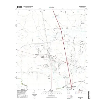
2014 Map of Kingsland
USGS Topo · Published 2014About this map
Kingsland and St. Marys serve as the primary hubs in this coastal Georgia landscape, where the modern expansion of neighborhoods like Forest Ridge and The Lakes meets a deep-rooted network of cemeteries and rural outposts. The coastal geography is defined by the winding Crooked River and its North Fork, creating a complex system of islands and hammocks such as Wrights Island and Floyd Hammock. Along the corridor of Us-17 and Interstate 95, smaller communities like Kinlaw and Wolfbay illustrate the transition from the city centers to the marshy lowlands near Shingle Swamp Island. For genealogists, the map is particularly useful for identifying family burial sites, including Zion Cem, Brazell Cem, and Sheffield Cem, which are tucked away near the many creeks and branches like Catfish Cr and Gum Br that drain toward the Atlantic coast.
Find a feature on this map
116 named features on this map. Tap any name to fly to it.
Don’t see what you’re looking for? This feature index may not catch every label — zoom into the map to look around manually.
Map Details
Editions of this 2014 Kingsland Map
This is the sole edition of this map. No revisions or reprints were ever made.
Other maps of this area

1917 · Boulogne
USGS Topo · 1:62,500

1917 · Hilliard
USGS Topo · 1:62,500

1918 · St Marys
USGS Topo · 1:62,500

1918 · Kingsland
USGS Topo · 1:62,500

1919 · St Marys
USGS Topo · 1:62,500

1919 · Hilliard
USGS Topo · 1:62,500

1919 · Boulogne
USGS Topo · 1:62,500

1948 · Jacksonville
USGS Topo · 1:250,000

1957 · Jacksonville
USGS Topo · 1:250,000

1958 · Gross
USGS Topo · 1:24,000