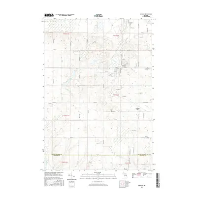
2017 Map of Kingsley
USGS Topo · Published 2017About this map
Kingsley and Summit City anchor this portion of Grand Traverse County, where the transition from organized village streets to sprawling wetlands is clearly defined. The terrain is characterized by numerous water features, including the expansive Weidenhamer Swamp in the north and the Big Marsh toward the south. For genealogists and local historians, the area is notable for its numerous burial sites scattered across the township, such as Barnum Cem, Evergreen Cem, and the more isolated Jenny Grave near the eastern boundary. The mapping of Kingsley Cr and Swainston Cr illustrates the drainage patterns through these rural highlands, while the southern edge of the sheet follows the county line toward Baxter, marking the interface with Wexford County.
Find a feature on this map
96 named features on this map. Tap any name to fly to it.
Don’t see what you’re looking for? This feature index may not catch every label — zoom into the map to look around manually.
Map Details
Editions of this 2017 Kingsley Map
This is the sole edition of this map. No revisions or reprints were ever made.
Other maps of this area

1954 · Traverse City
USGS Topo · 1:250,000

1956 · Fife Lake
USGS Topo · 1:62,500

1956 · Kingsley
USGS Topo · 1:62,500

1956 · Mesick
USGS Topo · 1:62,500

1956 · Cadillac North
USGS Topo · 1:62,500

1958 · Traverse City
USGS Topo · 1:250,000

1983 · Cadillac
USGS Topo · 1:100,000

1983 · Manton
USGS Topo · 1:25,000

1983 · Buckley
USGS Topo · 1:25,000

1983 · Traverse City
USGS Topo · 1:100,000
Featured Places
- Blair Township, MI
- Paradise Township, MI
- Mayfield Township, MI
- Kingsley, Paradise Township
- Hanover Township, MI