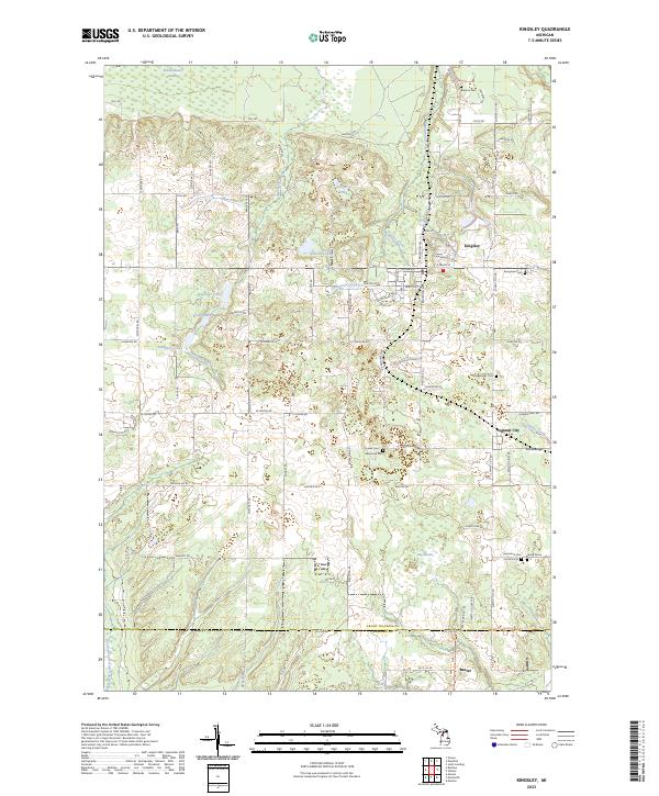
2023 Map of Kingsley
USGS Topo · Published 2023About this map
Kingsley serves as the central hub of this northern Michigan landscape, where the grid of residential streets like S Brownson Ave and Blair St gives way to a sprawling network of farms and wetlands. The area is defined by its numerous water bodies and drainage systems, including the Weidenhamer Swamp in the north and the broad Big Marsh to the south. Local history is etched into the terrain through several small burial grounds, such as Barnum Cem and Seegmiller Cem, along with the curiously named Jenny Grave near the eastern border.
Find a feature on this map
100 named features on this map. Tap any name to fly to it.
Don’t see what you’re looking for? This feature index may not catch every label — zoom into the map to look around manually.
Map Details
Editions of this 2023 Kingsley Map
This is the sole edition of this map. No revisions or reprints were ever made.
Other maps of this area

1954 · Traverse City
USGS Topo · 1:250,000

1956 · Fife Lake
USGS Topo · 1:62,500

1956 · Kingsley
USGS Topo · 1:62,500

1956 · Mesick
USGS Topo · 1:62,500

1956 · Cadillac North
USGS Topo · 1:62,500

1958 · Traverse City
USGS Topo · 1:250,000

1983 · Cadillac
USGS Topo · 1:100,000

1983 · Manton
USGS Topo · 1:25,000

1983 · Buckley
USGS Topo · 1:25,000

1983 · Traverse City
USGS Topo · 1:100,000
Featured Places
- Blair Township, MI
- Paradise Township, MI
- Mayfield Township, MI
- Kingsley, Paradise Township
- Hanover Township, MI