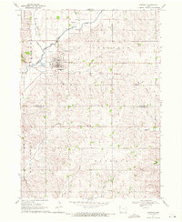
1969 Map of Kingsley
USGS Topo · Published 1971About this map
Kingsley serves as the central hub of this 1969 survey, situated at the intersection of Plymouth and Woodbury counties. The town's grid is surrounded by a rural landscape defined by the winding paths of the Little Sioux River and the West Fork Elkhorn Creek. A notable trace of former industry and transport is visible in the Old Railroad Grade running east from the town center, a feature of significant interest for local historians tracking the evolution of rail corridors in western Iowa.
Find a feature on this map
22 named features on this map. Tap any name to fly to it.
Don’t see what you’re looking for? This feature index may not catch every label — zoom into the map to look around manually.
Map Details
Editions of this 1969 Kingsley Map
This is the sole edition of this map. No revisions or reprints were ever made.
Other maps of this area

1954 · Fort Dodge
USGS Topo · 1:250,000

1955 · Sioux City
USGS Topo · 1:250,000

1957 · Fort Dodge
USGS Topo · 1:250,000

1958 · Sioux City
USGS Topo · 1:250,000

1958 · Fort Dodge
USGS Topo · 1:250,000

1959 · Sioux City
USGS Topo · 1:250,000

1962 · Union Center
USGS Topo · 1:62,500

1964 · Moville
USGS Topo · 1:24,000

1969 · Pierson
USGS Topo · 1:24,000

1969 · Correctionville NW
USGS Topo · 1:24,000