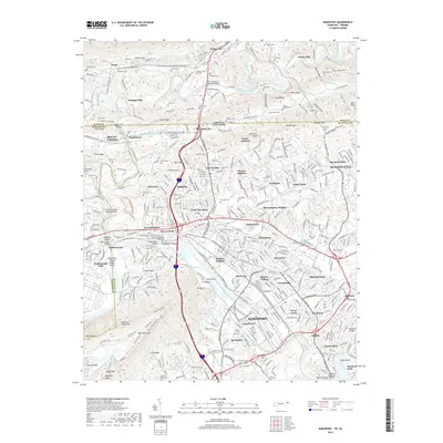
2019 Map of Kingsport
USGS Topo · Published 2019About this map
The North Fork Holston River and South Fork Holston River converge here, framing the industrial and residential development of Kingsport. This terrain is defined by the significant ridges of Bays Mountain and Walker Mtn, which have historically funneled transportation and settlement into the Poor Valley and Carter Valley. The presence of Old Kingsport and the Boatyard Methodist Episcopal church points to the area's deep roots as a river-based transit hub, while markers like Fort Robinson and Tilthammer Shoals recall the early military and industrial efforts to harness the river's power. Northward, smaller agricultural and residential clusters like Winegar Mill and Yuma sit near the Virginia state line, connected by the winding path of the Southern railroad. The map details numerous family cemeteries, such as Wolfe Cem and Catron Cem, providing a precise record of local genealogy across the Tennessee-Virginia border.
Find a feature on this map
403 named features on this map. Tap any name to fly to it.
Don’t see what you’re looking for? This feature index may not catch every label — zoom into the map to look around manually.
Map Details
Editions of this 2019 Kingsport Map
This is the sole edition of this map. No revisions or reprints were ever made.
Other maps of this area

1891 · Roan Mountain
USGS Topo · 1:125,000

1892 · Greeneville
USGS Topo · 1:125,000

1894 · Roan Mountain
USGS Topo · 1:125,000

1894 · Estillville
USGS Topo · 1:125,000

1896 · Greeneville
USGS Topo · 1:125,000

1897 · Bristol
USGS Topo · 1:125,000

1902 · Bristol
USGS Topo · 1:125,000

1904 · Roan Mountain
USGS Topo · 1:125,000

1904 · Greeneville
USGS Topo · 1:125,000

1935 · Hilton
USGS Topo · 1:24,000