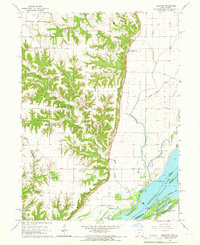
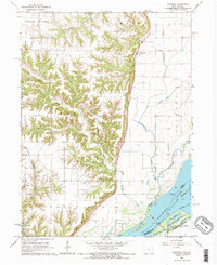
1964 Map of Kingston
USGS Topo · Published 1966About this map
Kingston serves as a focal point along the bluff line where the uplands of Benton and Huron townships drop toward the broad bottomlands of the Mississippi River. This mid-century survey reveals a landscape defined by the transition from rugged, wooded drainages like Yellow Spring Creek and Benton Creek to the engineered hydrology of the river valley. The agricultural character of the era is evidenced by small settlements like Latty and Dolby, alongside local landmarks such as St Marys Ch and Walker Cem. Along the river, the presence of Lock and Dam No 18 and a complex network of backwaters, including Running Slough and Swift Slough, illustrates the managed waterway systems of the 1960s. The Chicago Rock Island and Pacific railroad tracks cut through the southwestern corner, providing a vital link for the rural communities of Des Moines County.
Find a feature on this map
34 named features on this map. Tap any name to fly to it.
Don’t see what you’re looking for? This feature index may not catch every label — zoom into the map to look around manually.
Map Details
Editions of this 1964 Kingston Map
2 editions found
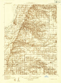
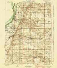
Other maps of this area
1934 · Oquawka
USGS Topo · 1:48,000

1934 · Burlington
USGS Topo · 1:48,000

1935 · Keithsburg
USGS Topo · 1:48,000
1940 · Oquawka
USGS Topo · 1:62,500

1940 · Burlington
USGS Topo · 1:62,500

1941 · Keithsburg
USGS Topo · 1:62,500

1946 · Wapello
USGS Topo · 1:62,500

1949 · Wapello
USGS Topo · 1:62,500

1958 · Burlington
USGS Topo · 1:250,000

1958 · Davenport
USGS Topo · 1:250,000