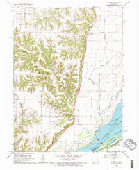
1964 Map of Kingston
USGS Topo · Published 1966About this map
The bluffs of Benton and Huron townships drop sharply into the alluvial lowlands of the Mississippi River, creating a landscape defined by sharp elevation shifts and intricate water systems. The Chicago Rock Island and Pacific railroad cuts through the western uplands, serving small communities like Latty and passing near the Walker Cem. Along the river’s edge, the hydrology is complex, featuring the Jackson Slough, Running Slough, and numerous islands such as Little Rag Island and Big Dasher Island.
Find a feature on this map
40 named features on this map. Tap any name to fly to it.
Don’t see what you’re looking for? This feature index may not catch every label — zoom into the map to look around manually.
Map Details
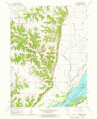
Editions of this 1964 Kingston Map
2 editions found
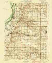
Other maps of this area
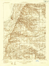
1934 · Oquawka
USGS Topo · 1:48,000

1934 · Burlington
USGS Topo · 1:48,000

1935 · Keithsburg
USGS Topo · 1:48,000
1940 · Oquawka
USGS Topo · 1:62,500

1940 · Burlington
USGS Topo · 1:62,500

1941 · Keithsburg
USGS Topo · 1:62,500

1946 · Wapello
USGS Topo · 1:62,500

1949 · Wapello
USGS Topo · 1:62,500

1958 · Burlington
USGS Topo · 1:250,000

1958 · Davenport
USGS Topo · 1:250,000