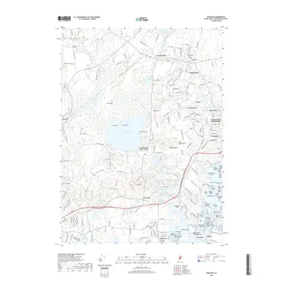
2018 Map of Kingston
USGS Topo · Published 2018About this map
Great Swamp and the expansive Worden Pond dominate the central landscape of this South County survey, illustrating the complex wetland ecosystems that have shaped local settlement patterns for centuries. To the north, the Univ of Rhode Island campus sits at Kingston Hill, anchoring the village of Kingston. The map documents the critical transit infrastructure of the region, from the Richmond Airport on the western edge to the Amtrak line passing through West Kingston. Moving south toward the Atlantic, the terrain transitions into a dense network of coastal ponds and points, including Tucker Pond and Round Pond, before reaching the waterfront communities of Jerusalem and Galilee. This 2018 record shows how the historic villages of Wakefield and Wakefield-Peacedale have integrated with the surrounding water resources, such as the Peace Dale Reservoir and Rocky Brook Reservoir.
Find a feature on this map
109 named features on this map. Tap any name to fly to it.
Don’t see what you’re looking for? This feature index may not catch every label — zoom into the map to look around manually.
Map Details
Editions of this 2018 Kingston Map
This is the sole edition of this map. No revisions or reprints were ever made.
Other maps of this area

1889 · Charlestown
USGS Topo · 1:62,500

1889 · Newport
USGS Topo · 1:62,500

1890 · Narragansett Bay
USGS Topo · 1:62,500

1890 · Kent
USGS Topo · 1:62,500

1892 · Narragansett Bay
USGS Topo · 1:62,500

1894 · Kent
USGS Topo · 1:62,500

1894 · Newport
USGS Topo · 1:62,500

1904 · Newport
USGS Topo · 1:62,500

1919 · Charlestown
USGS Topo · 1:62,500

1919 · Narragansett Bay
USGS Topo · 1:62,500