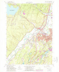
1964 Map of Kingston West
USGS Topo · Published 1989About this map
Esopus Creek winds past the burgeoning suburban developments of Hurley and Lincoln Park as they expanded toward the mid-century. This survey illustrates the vital infrastructure of the era, from the massive Ashokan Reservoir at the western edge to the Filtration Plant and Municipal Stadium serving the local population. The landscape is a mix of industrial and institutional landmarks, including the County Hospital and several parochial sites like St Josephs Sch and St Josephs Hall.
Find a feature on this map
73 named features on this map. Tap any name to fly to it.
Don’t see what you’re looking for? This feature index may not catch every label — zoom into the map to look around manually.
Map Details
Editions of this 1964 Kingston West Map
4 editions found
Other maps of this area

1892 · Kaaterskill
USGS Topo · 1:62,500

1893 · Kaaterskill
USGS Topo · 1:62,500

1894 · Kaaterskill
USGS Topo · 1:62,500

1895 · Catskill
USGS Topo · 1:62,500

1898 · Rhinebeck
USGS Topo · 1:62,500

1899 · Kaaterskill
USGS Topo · 1:62,500

1901 · Rosendale
USGS Topo · 1:62,500

1903 · Rosendale
USGS Topo · 1:62,500

1903 · Kaaterskill
USGS Topo · 1:62,500

1934 · Rhinebeck
USGS Topo · 1:48,000