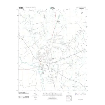
2011 Map of Kingstree
USGS Topo · Published 2011About this map
Black River dominates the western landscape of this Williamsburg County region, winding past the county seat at Kingstree. The town’s 21st-century layout shows a mix of historical core features and modern development, including the Kingstree Post Office and the Wallace D Conner Bridge crossing. Residential growth is evident in suburban pockets like Woodland Acres and the community of Brockington to the north.
Find a feature on this map
111 named features on this map. Tap any name to fly to it.
Don’t see what you’re looking for? This feature index may not catch every label — zoom into the map to look around manually.
Map Details
Editions of this 2011 Kingstree Map
This is the sole edition of this map. No revisions or reprints were ever made.
Other maps of this area

1946 · Hyman
USGS Topo · 1:62,500

1946 · Kingstree
USGS Topo · 1:62,500

1946 · Lake City
USGS Topo · 1:62,500

1946 · Indiantown
USGS Topo · 1:62,500

1949 · Georgetown
USGS Topo · 1:250,000

1967 · Georgetown
USGS Topo · 1:250,000

1974 · Georgetown
USGS Topo · 1:250,000

1986 · Kingstree
USGS Topo · 1:100,000
1990 · Hebron Crossroads
USGS Topo · 1:24,000
1990 · Lake City East
USGS Topo · 1:24,000