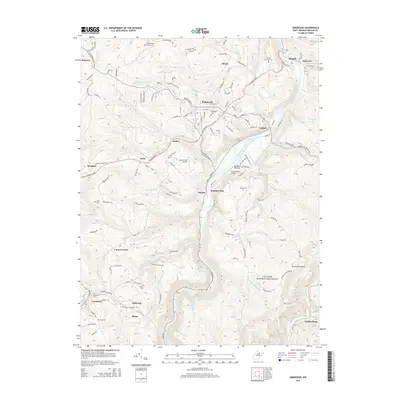
2014 Map of Kingwood
USGS Topo · Published 2014About this map
Kingwood serves as the focal point of this Preston County landscape, situated on the high ground west of the Cheat River. The river forms a major topographic corridor, winding past Dunkard Bottom and Caddell as it flows north toward Albright. This 2014 survey documents a region defined by scattered mountain settlements and specialized facilities, including the military presence at CTC Camp Dawson-Kingwood and its associated Dawson Army Airfield.
Find a feature on this map
52 named features on this map. Tap any name to fly to it.
Don’t see what you’re looking for? This feature index may not catch every label — zoom into the map to look around manually.
Map Details
Editions of this 2014 Kingwood Map
This is the sole edition of this map. No revisions or reprints were ever made.
Other maps of this area

1886 · St. George
USGS Topo · 1:125,000

1891 · St. George
USGS Topo · 1:125,000

1902 · Morgantown
USGS Topo · 1:62,500

1904 · Bruceton
USGS Topo · 1:62,500

1907 · Thornton
USGS Topo · 1:62,500

1907 · Kingwood
USGS Topo · 1:62,500

1925 · Kingwood
USGS Topo · 1:62,500

1925 · Morgantown
USGS Topo · 1:62,500

1926 · Thornton
USGS Topo · 1:62,500

1926 · Bruceton
USGS Topo · 1:62,500